USA 23 -Awe inspiring views from the Great Smoky Mountains, the Blue Ridge Mountain Parkway and Shenandoah’s Skyline Drive.

2nd May – 19th May  Amongst the oldest on earth, The Great Smoky Mountains escaped the Ice Age glaciers as they stopped their southward journey just short of these mountains.   A smoke-like, natural, bluish haze and mist-like clouds that rise following a rain storm, provided the inspiration for the name Smoky Mountains.  The Cherokee Indians described them as ‘shaconage’ meaning ‘ blue, like smoke’ and for these Indians, the Great Smokies have provided a refuge and a mythical and spiritual homeland for their people.   Sadly today, a haze that washes out the colours and textures and hides the horizon, is very often caused by pollution.

Looking out across the Smoky Mountain landscape fading far into the distance, how did this land come to be?  The Cherokee had a lovely story………

“They carefully got all the mud and they laid it out on the rocks.  And when it was dry enough, Grandfather threw it out into the water, and it became land.  And the buzzard flew with his great wings.  Each time when his wings went down it would make a big valley, and each time the wings would go up, it would make a big mountain.”

IMG 8332

IMG 8323

A paved road takes us to Newfound Gap at 5,046 ft. and which marks the Tennessee and North Carolina state line.  A turn off to a parking area and then a half-mile steep climb takes us even higher to  Clingmans Dome, a sacred mountain to the Cherokees, where The magic Lake was once seen and which according to The Great Spirit, would make the old and sick well again.   A spiral ramp leads up to the look-out tower…..providing panoramic views from this highest point in the park.  The high altitude forests surrounding the tower, are comprised mostly of Red Spruce and Fraser Fir but it is a forest under stress, with many of the dead trees victims of acid rain and an insect known as the balsam wooly adelgid which rapidly kills the firs by feeding on the tree sap.

IMG 8364

IMG 8360

Below us, the famous Appalachian Trail winds its way some 70 miles along the Great Smoky’s crest and the Tennessee-North Carolina border, just a small part of its 2,174 mile scenic length  that stretches from Georgia’s Springer Mountain to Maine’s Mount Katahdin.  It was great to chat with this couple and their dog who had stopped here for a breather before continuing on their way north along this trail, back to their homes in Maine.

IMG 8370

From here we follow Little River and Laurel Creek roads to Cades Cove in Tennessee.  The 11 mile loop road here traces its history to 1818 and there are many interesting sites to stop at such as   the Primitive Baptist Church, organized in 1827 and which guards a small graveyard, where time and weather have erased many of the names from the stones.  Also, a log cabin hidden amongst the trees that belonged to John and Lucretia Oliver.  They were amongst the first settlers to arrive here and  it’s easy to see what drew them to this place when you stand in the porch and see the beautiful green valley and distant mountains spread out before you.

IMG 8446

IMG 8413

IMG 8411

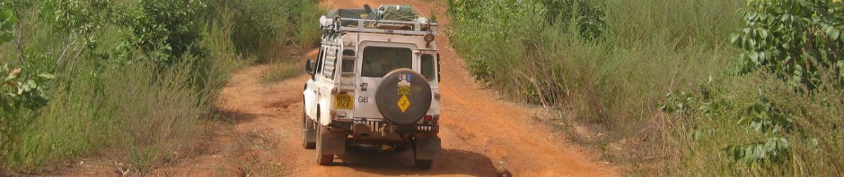
From Cades Cove we take Parson Branch Road, a narrow, winding, one-way dirt road carved out of the wilderness where forests and streams meet the track and where we encounter a black bear with her two cubs.  To our amazement she leaves them at the bottom of a chosen tree whilst she nimbly climbs it and helps herself to some large and obviously, very tasty flowers.

IMG 8570

IMG 8538

IMG 8501

IMG 8539

Parson Branch Road will eventually take us out of the Great Smoky Mountains National Park, but not before we leave Tennessee and cross the state line back into North Carolina with views of Fontana Lake, a ribbon of blue nestled amongst forested hills.

IMG 8579

Another good night camping at the Great Smoky Mountain Meadows Campground just outside Bryson City before we set out the next day for the start of the Blue Ridge Parkway, another of America’s favourite scenic drives, extending 469 miles along the crests of the Southern Appalachian Mountains and linking the Great Smoky Mountains that we have just left and the Shenandoah National Park in Virginia.  Once again, this slow-paced and leisurely winding drive passes numerous viewing stops, offering spectacular long-range views of mountains and lowland as it climbs or descends to different elevations.

IMG 8593

IMG 8633

Woolyback Overlook – 5425 ft.

IMG 8665

Brooding clouds cover Roy Taylor Forest Overlook – 5580 ft.

IMG 8641

IMG 8679

Highest Point on the Blue Ridge Highway – 6053 ft.

IMG 8687

View looking across the Pisgah Forest.

We stop at Mount Pisgah Campground at just over 5000 ft.  Practically deserted, so plenty of space and very peaceful but no electricity on the sites so it could be a cold night after the very warm daytime temperatures.  Not only however, does the discovery of hot showers in the restrooms make this a great campsite after a long day, but the spring flowers  and wildlife here also make this a very special place……..

IMG 8731

IMG 8805IMG 8808

IMG 8725IMG 8654

IMG 8697IMG 8765

IMG 8772IMG 8739

IMG 8708

Looking Glass Rock has been a landmark in these mountains for generations.

IMG 8847

Green Knob Overlook – 4760 ft.

Even at these higher elevations Spring is arriving with Rhododendrons and the beautiful yellow petals of the Southern Magnolia tree beginning to flower,

IMG 8723

IMG 8842

We camp at Linville Falls Campground amongst shady trees and green meadows edged by forest and follow a trail that takes us to Chimney View, where both the upper and lower falls can be seen.   Beginning high amongst the steep slopes of Grandfather Mountain, the Linville River begins an almost 2000 ft. descent through a rugged and spectacularly beautiful gorge, known to the Cherokee Indians as ‘river of cliffs.’

IMG 8881

We drive the Linn Cove Viaduct, once a 7 mile unfinished section of the Blue Ridge Parkway that was  delayed for 20 years whilst environmentalists, landowners, engineers and architects combined their skills to work out how best to preserve the scenic and fragile environment that covered the slopes of Grandfather Mountain.

A stop at The Northwest Trading Post and we are stocked up with some delicious squares of Rocky Road and Vanilla Chocolate homemade fudge made in Nancy’s Candy Store in Virginia, a jar of Sally Mae’s Blueberry Jam from N. Carolina and a tube of Naked Bee’s Orange Blossom & Honey Hand and Body Lotion that smells divine.

We cross the state line into Virginia and make a call at the Blue Ridge Music Centre, where sounds of of the fiddle, banjo and guitar welcome us, aiming to provide the visitor with an insight into the history of ‘The Roots of American Music,’  which is said to be a natural part of these mountains.

Not far from Meadows Dan, is today, one of the most photographed features on the Blue Ridge Parkway…….the very picturesque Mabry Mill, photos of which can be found on numerous postcards, as well as gracing the pages of countless calendars and books.

IMG 8974

This mill was built about 1910 by Edwin Mabry, a ‘ jack-of-all-trades ‘ who was talented in many skills, having been a chair-maker, a miner, a blacksmith and a farmer. Ed and his wife Lizzie, operated the mill until about 1936, grinding corn and sawing lumber for their neighbours, thereby creating a gathering point for the local community.  We have lunch in the nearby little restaurant and buy ice creams to take outside and eat in the sun.  Here we join up with Randy Galleon, a great guy enjoying the freedom of being out on his gleaming chrome and white Harley.  He tells us that he is in the process of making an extra seat for their little dog Princess, so that his wife will accompany him too!  Safe travelling Randy!

IMG 9017

As we slowly descend we have views of the Roanoke Valley, white farmsteads nestling amongst lush, green fields and dense forest.

IMG 9117

The big town of Roanoke provides us with some essentials, a super market, the chance to check emails and get some cash and fuel.  From here it’s on to Otters Peak Campground where we are the only campers on the lower level.  Deer wander through the trees just before dusk and coyotes howl in the distance after dark.  In the morning, an interesting talk with one of the park rangers, reveals that he has been living in a log cabin on the Parkway for 27 years, with no hot water and using a bow and arrow for hunting.

IMG 9138

After leaving Otters Peak, we pass over Virginia’s highest elevation on the Parkway at 3950 ft. and then descend to the beautiful James River where the Blue Ridge Parkway dips to its lowest  elevation, just 640 ft. above sea level.  Named after King James 1st, this huge river with abundant water and warmer temperatures, supports different plant and animal life to other areas on the Parkway.

IMG 9217

We only have about 20 miles left before we reach the northern end of the Blue Ridge Parkway.  From here we begin the Skyline Scenic Drive through the Shenandoah National Park, a narrow mountain road with still more beautiful, panoramic views to the horizon and over 500 miles of trails.  The park is a sanctuary for plants and animals.  Hunting is prohibited, although sadly we learn that illegal poaching is still continuing.

Established in 1935,  Shenandoah runs for just over one hundred miles along the crest of the Blue Ridge Mountains, with the Appalachian Trail running roughly parallel to it for nearly its entire length.  Unlike most other parks, Shenandoah was a place where settlers had lived for over a century, and to create the park, state officials acquired over 1,000 privately owned tracts of land and donated them to the nation.

Loft Mountain Campground will provide our first night of camping on the Skyline Drive and whilst looking for a camping site, we meet up with the Wickens family in their big motorhome which they shipped from Surrey, England.  Clare and John and their 2 great boys Charlie and Will, who have been doing home schooling whilst away.  But what an education their journey has been!  Both boys talk enthusiastically about this and show us their diaries, which prove just how knowledgeable they have become.  We enjoy a seat and a cup of English tea in their spacious motorhome and share stories.  It’s a cold night camping however, at just under 3500 ft.

We wish you guys a safe journey back home and a big thank you to John for offering us their single gas ring, fired by small propane gas canisters that can be bought in the USA.  A really kind offer, as our last, large European canister that we are unable to get filled in the States because of the different fittings, is feeling very light and certainly won’t last to the end of our trip.  Many thanks everyone.  Much appreciated!

IMG 9298

Spring begins in the valleys of Shenandoah and then also has to slowly climb up the mountainsides.  Today, the marks of early lumbering, grazing and farming have mostly disappeared and the mountain slopes appear densely forested and so green.

IMG 9300

Ivy Creek Overlook  2885 ft.

IMG 9327

Pinnacles Overlook  3320 ft.

IMG 9366

Hazy mountains at Range View Overlook, after leaving Mathews Arm Campground.  Many of Shenandoah’s highest peaks can be seen from here.

IMG 9397

Spring is arriving!

But as we near the end of Shenandoah’s Skyline Drive, the view is beginning to change.  Farms and agricultural land, housing and commercial businesses are taking over the woodland and pastures down in the valley.  A changing landscape, and we wonder what it will look like in another 20 years time!

The last weeks have rewarded us with unexpected wildlife sightings, signs of spring amongst the flora,  spectacular, changing vistas and vast, panoramic views, but now, as these fade into the horizon’s blue haze, we have to try and adjust to being back amongst heavy traffic and impatient drivers in Front Royal, our first big town.

The coming weekend will be a busy one with Memorial day Celebrations and most people will be taking a holiday outside of town.  On to Interstate 81, which could be a highway anywhere in the UK with familiar names now appearing on our map such as Winchester, Rochester, Dover, Aberdeen, Bradford……to name just a few.

We decide to try and make it up to Niagara Falls before the big holday weekend.


Save

Posted in USA | Tagged | 2 Comments

USA 22 – Georgia and the beautiful South and North Carolinas.

16th April  – 2nd May  So it’s goodbye to Florida’s  beautiful ‘Forgotten Coast’ around the Gulf of Mexico.  How lucky we have been to share its stunning, deserted beaches, fantastic wildlife and great State Parks that provided us with excellent camping.

We take the scenic route instead of staying on Interstate 95 and head towards Savannah, oldest city in the U.S. State of Georgia and famous for its Historic Downtown District.  This is an area of the city to be walked around to appreciate some of the beautiful and elegant homes that line many of its streets, shaded by rows of huge live oak trees, their massive branches draped with Spanish moss that thrives in this humid, subtropical climate.  Surprisingly, we learn that despite its name, Spanish moss is neither a moss, nor of Spanish origin but a member of the Bromeliad family, native to the Americas.

IMG 7711

IMG 7712

IMG 7719

Situated on the Savannah River and today an important seaport, this city has been in danger from hurricanes and flooding and we remember seeing signs on our journey for evacuation routes.  The river front area is lined with a row of towering brick warehouses which have now been converted into accommodation, shops, restaurants, cafes, art galleries and even a brewery.  Paddle boats, such as the Georgia Queen, ply the river offering riverboat cruises  and a chance to view the city from a different perspective.

IMG 7764

IMG 7754

Said to be alive with spirited experiences Savannah is a great city with a relaxed atmosphere, where people dance to the street musicians who entertain with pop, rap and country and western, enjoy outdoor eating, browsing the shops  or relaxing in one of the many squares.

IMG 7738 IMG 7765

IMG 7721

IMG 7775

We end our first day here with a lovely meal in the River House Seafood Restaurant….char-grilled Mahe fish topped with crabmeat chunks on roasted, red-skinned potatoes with asparagus.  A great meal and just in time to celebrate my birthday, as most of this day has been spent driving the miles between leaving Florida and arriving in Savannah.

Thunderstorms and torrential rain seem to be a daily occurrence however, and today is no exception as the darkened sky and strong wind sweep a curtain of rain over the bridge as we cross the  Savannah River leaving Georgia  behind and continuing into South Carolina.

Our first campsite here is at Santee State Park by Lake Marion, created along with Lake Moultrie by the damming of major waterways flowing out to the Atlantic at Charleston.  It’s an eerie feeling to think of the farms, houses, roads and forests that lay under Lake Marion’s waters.  As always, this State Park is very good value with water and electricity at each site plus a restroom amongst the trees with wonderful, hot showers.  This evening I share one with a pale green tree frog.  There is a sudden splat at my feet and I look down to what I think is a mushy bird dropping.  I look up into the roof rafters for the bird, when all of a sudden, the green ‘mush’ jumps up on to the tiled wall, transformed into a pale green frog with yellow feet!  I can only presume that when he jumped from such a height, he flattened himself out to land in a jelly-like lump for protection…..amazing!

We notice a few fishermen still out on the water hoping to catch a striped bass or a big catfish perhaps, whilst trees on the opposite side of the lake are turning a pale, golden green, as the late sun suddenly appears from behind stormy clouds.

Our National Park Pass expires at the end of April, so we still have time for free entry to Congaree National Park  and then on to the Great Smoky Mountains.

Congaree is known for its diverse plant and animal life and its forest of towering trees…….giant loblolly pines, hickories and bald cypress, their growth depending upon the rich soils deposited by the floodwaters of the Congaree and Wateree rivers when they overflow.  Many of the boardwalks were under water on our visit due to unusually late flooding from the recent, heavy rains but it’s a tranquil walk through these forests with a heavy silence as the waters rise, dappled by sunlight filtering through the canopy.

IMG 7789

IMG 7843

IMG 7798

IMG 7780

IMG 7824

IMG 7821

IMG 7796

From Congaree we head to the beautifully kept 1,000 acre Poinsett State Park for camping, where the lake is presently full of enormous tadpoles.  Our secluded corner with immaculate bathrooms and hot showers nearby, quickly becomes one of our favourites.

IMG 7879

IMG 7891

Dreher Island State Park in the Midlands area provides our next night’s camping.  Covering 348 acres and spanning 3 islands, it also provides 12 miles of Lake Murray shoreline and is therefore a big attraction for boating enthusiasts and fishermen.

Stopping at Chapin the next day, we are putting away our shopping when a vehicle pulls up alongside having recognised our English number plates. “You’re a long way from home,” a voice exclaims with a very strong English accent, and we meet Pete and Jean with their little dog Dodger.  A kind invite for coffee and we follow them to their lovely home with a garden that sweeps down to the edge of Lake Murray.  Sitting on their balcony in the sun sharing stories, we are also treated to an unexpected lunch.  Once again, our Land Rover has brought us in touch with an unexpected meeting and another kind gesture from strangers.  A big thank you for such an interesting and relaxing afternoon.

Today we depart for White Oaks Campground in Table Rock State Park, set amongst densely forested hills and close to the border with North Carolina.  Our camping neighbours are John and wife Chris with their 1969 GMC pickup that’s been converted into a hard top camper.  Canoe and windsurfer are on the roof and bicycles on the back, it looks a great vehicle, full of character and gets John away into the wilds.  Whilst he disappears, Chris organises her own disappearing act with her 2 horses, truck and trailer, trail riding through southern Utah for maybe a week or more.  Great lives both of them and whilst the men talk vehicles and mechanics, I enjoy talking horses with Chris!

IMG 7919

Table Rock State Park provides over 11 miles of hiking trails with various difficulty ratings, distances and estimated times of travel, making registration at the Trail Head a necessity before setting out on one.   We decide to try the 7.2 mile (there and back) Table Rock Trail, with a strenuous rating.  It’s a tough climb due to numerous, steep stone and log staircases, exposed roots, boulders and rock outcrops, not forgetting the two black rat snakes that decide to cross our path (not poisonous apparently) but if we run out of steam we can stop at the half way trailside shelter.

IMG 7974 IMG 7943

IMG 7967

IMG 7971

Time for a rest at Governor’s Rock and to admire the view……….

IMG 8001

……….and of course everyone tells us that we have not far to go now and that the views are worth making that final effort to get to the top.  So on we go, still a challenging climb, another snake and watching constantly all the things on the trail that are just waiting to trip us up…..that alone is tiring.   However the view at the  summit  (3124 feet) of lakes and forested hills stretching to the horizon from a huge rocky outcrop, is spectacular……

IMG 8014

IMG 8019

………..but the descent, as is often the way, was even harder!  Revived by a hot shower once back at camp, but I think we will sleep well tonight!

Heading for the KOA Campground just east of Asheville in North Carolina today, where we have had a parcel delivered containing some Land Rover parts from the UK.  The camping areas are in a lovely, peaceful setting amongst 3 lakes and a river with an assortment of geese and ducks who have learned to come running  whenever they hear the rustle of a paper bag!  Spring is in the air with the Dogwood trees covered in white blossom and a pair of proud and very protective geese with their five baby goslings.

IMG 8169

IMG 8175

IMG 8166

IMG 8117

Asheville……playground of the rich and famous in the 1920s.  Henry Ford, Thomas Edison, John D. Rockefeller and the Vanderbilts were among those that came here for relaxation.  Today, Asheville is a mecca for arts and crafts and the Downtown Art District is filled with galleries, museums and artist’s studios.  We enjoy a pavement lunch in the sun outside the very impressive Grove Arcade, full of locally owned shops with interesting names such as ‘Appalachian Strings’, ‘Enter the Earth’ and ‘4 Corners Home,’  featuring natural products,  jewellery and much more amongst its marble halls.

The Folk Art Centre, home of the Southern Highland Craft Guild is also worth a visit.  Membership of the Guild stands at more than 900 artisans, selected by a jury for the high quality of design and craftsmanship reflected in their work.  The exhibits included beautiful paintings and prints, jewellery, glass and pottery, furniture, clothes and accessories.

And of course, Asheville is home to the Blue Ridge Mountains and the famous Blue RIdge Mountain Parkway, a scenic mountain drive that runs between the Great Smoky Mountains and Shenandoah National Parks.

This is where we will head for next, but first we must back-track to Hendersonville to visit Brenton and Shannon and their new 3 month old little girl Emileen who is like a little doll and absolutely gorgeous.  Great to see them both after our first meeting with them in Bolivia and briefly at the Overland Expo in Arizona last year.  Also met Shannon’s mum and dad who very kindly lent Bill their fantastic garage/workshop to do a bit of maintenance on Moby…….Bill’s dream to have something like this one day!  Thank you all for the invite and kind hospitality, for the great meal Shannon and the luxury of a bed and ensuite for the night!

IMG 8304

Before heading into the Great Smoky Mountains National Park, we spend a couple of nights camping at the Smoky Mountain Meadows Campground just outside of Bryson City, a small town that borders the southern side of the park.  This campground is a real gem in a huge green meadow with running streams and shady trees.  Very spacious and peaceful as only a handful of people here.  We are invited for drinks around the campfire by a couple of guys with an RV parked not far from us but we eat late and then everyone is in bed.  As we missed their invitation, they arrive the next morning with a large slice of home made key lime pie and an aerosol can of whipped cream!

Before we leave for the Smoky Mountains, we make a visit to the Museum of the Cherokee Indians, once one of the largest tribes in the southeastern United States.  Here they lived peacefully alongside the land in the Great Smoky Mountains and the lowlands of the Southern Appalachians until Europeans arrived and the Cherokees were forced to fight fierce battles as their land began to be taken from them.  In 1835, 16,000 Cherokees were forced to leave what was left of their homeland and made to walk 1,200 miles west to Oklahoma, a harrowing journey during which thousands died from hunger, disease, exposure and exhaustion.  Their journey became known as the ‘Trail of Tears’.  Some however, managed to return to their homeland to establish the Eastern band of Cherokee Indians and now, this band lives on its reservation next to the Great Smoky Mountains National Park.

Across the road from the museum is the Qualla Arts and Crafts Mutual which represents the work of more than 300 artists, with many beautiful examples of Cherokee traditional art for sale and well worth a visit.  We will have to find a safe place in Moby for the small pot that we bought!

We leave the town of Cherokee and head into the Great Smoky Mountains National Park, one of America’s few National Parks where there is no charge to enter.   We have the whole of the Smokies to look forward to, followed by the Blue Ridge Mountains and Shenandoah National Park!

Save

Posted in USA | Tagged | 2 Comments

USA 21 – Florida’s ‘Forgotten Coast’ ……..one of Florida’s best-kept secrets!

26th March – 15th April  –  Never having visited Florida before, when I hear or see the word –  sunshine, The Keys, Orlando and Cape Canaveral spring to mind but  there is so much more to explore that is remote, laid-back and less developed.  If you like miles of white, deserted beaches and clear, aquamarine seas plus plenty of wildlife amongst the coastal marshlands, dunes, forests and barrier islands, then you will love this area of the Florida panhandle around the Gulf of Mexico, commonly known as ‘The Forgotten Coast.’

Although it is raining hard when we leave Alabama there is plenty of sunshine once in Florida.  Two bridges, the Pensacola Bay Bridge and then a toll bridge over the Santa Rosa Sound bring us to Santa Rosa Island, part of the Gulf Islands National Seashore.

IMG 6656


This fragile island has weathered numerous hurricanes, acting as a barrier during violent storms by helping to block the ocean’s waves that might otherwise strike the mainland with greater force.  Located along Florida’s famous Emerald Coast, the beach stretches into the distance, its white sand made up of tiny quartz crystals, held together by plants that have adapted to this harsh environment where the wind and waves are constantly reshaping the island.  It is a habitat for many shore birds, small animals and nesting sea turtles but the latter not until a bit later in the year.

IMG 6329

IMG 6343

IMG 6398

IMG 6394

The U.S. government began fortifying Pensacola in the 1800s and Fort Pickens was completed in 1834 on Santa Rosa Island.  The largest of 4 forts that were built to protect the bay, Pickens played a critical role in preserving peace and as an obstacle to invaders.

IMG 6610

IMG 6611

A walk to this fort is a must, following one of the many walking trails on the island.  We stop on a small bridge over a bayou to admire a heron standing motionless on a log with two turtles, watch other herons nesting and wait patiently on the bridge for more turtles to arrive.

IMG 6566

IMG 6547

IMG 6621

IMG 6598

IMG 6584

Fort Pickens Campground is located on Santa Rosa Island, with all amenities and only short walking distances to either the Gulf of Mexico with its miles of white sand beaches, or calmer Pensacola Bay.   More trails can be followed inland through the centre of the island, where ospreys are guarding their nests in high trees.  We never tire of watching these beautiful birds that seem to be surprisingly used to people.

IMG 6438

IMG 6439

IMG 6466

IMG 6367

IMG 6474  IMG 6534

IMG 6364

Back at our campground we meet Dolly and Steve who bring us over some delicious cookies from Louisiana and Lois and her husband from Madison in Wisconsin who are intrigued by our number plate.  She gives us their home address in case we are passing that way.  More kind gestures from strangers but who share the same interest of travelling and camping.

The evening before we leave, an osprey lands in a nearby tree clutching a large fish that it has caught.  We seem to have arrived at a great time for watching wildlife!

IMG 6488

And so we decide to move on from this beautiful, wild and natural campground a little further along to Destin, where we have been told by the Visitor  Centre that there is only one camping space left at the Topsail Hill State Park….first come, first served so they won’t reserve.  As it happens, when we arrive we have 4 places to choose from.  We have come to the conclusion that  there is more chance of getting a space if we appear in person, rather than making a phone call.  Perhaps I will eat my words later on, as all campsites are very full at the moment due to schools closed for the Easter break.

This campground resembles a huge parkland that would have belonged to an estate.  In fact it once belonged to two ladies who donated it to the government with the provision that it would be kept in its natural state and not  built on. Its habitat is unique in that it has many large lakes, some amongst the campground and others nearer the beach.  It’s interesting to see how the vegetation changes out on the hiking trails that eventually lead down to the sea, often sheltered by large dunes and pine trees.

IMG 6686

IMG 6675

IMG 6708

IMG 6718

IMG 6721

IMG 6731

Fighter planes are coming in to land as we pass the Tyndall Air Force Base continuing on our way around the coast for Mexico Beach.  The sugar-like white sand that makes up this long stretch of beach, is quite rare in that it contains only evenly sized quartz crystals that originated millions of years ago in the Appalachian Mountains. Because the area lacks the influence of silt-bearing rivers, the sand here has remained pure and white.  Mexico Beach is also said to average 320 days of sunshine a year and today is no exception!

A short distance from here is Port St. Joe and we head out along the narrow peninsula with fingers crossed that we will find a camping place at St. Joseph Peninsular State Park. Not so lucky this time however, but we are allowed to camp overnight in the overflow parking area and hopefully we can get a site tomorrow.  The ‘no-see-ums’ arrive at dusk, biting relentlessly and finding their way through our mosquito netting.  It’s a quiet night as we are the only people here.

We are surprised to see deer amongst the dunes as we arrive at the park gate office at 8.a.m. the next morning and finally manage to get a camping place for one night.  The dunes in this state park are said to be the tallest east of Mississippi.

IMG 6794

Opened in 1967 and located across the bay from Port St. Joe on a long strip of land, St Joseph Peninsular State Park  has some 9 miles of white sand beaches and aqua-blue waters.  Hiking can be next to the open ocean, where a fisherman tells us that a little while ago, a large shark swam past him close to the shore …………

IMG 6809

IMG 6820

………or through the interior to the sheltered bay with calmer waters, where pelicans and other sea birds rest and watch the world go by.

IMG 6860

IMG 6857

Continuing our way around the Gulf to St. George Island, we pass through the small town of Apalachicola.  Once the 3rd largest port on the Gulf of Mexico,its waters were once filled with steamboats and schooners, with railroads and lumber mills close by.  Today this town has lots of charm with its tree lined streets, a good choice of cafes and restaurants  serving fresh sea food, art galleries and many individual specialist shops, plus a working waterfront, the river and bay providing great salt and fresh water fishing.

St. George Island State Park is another of Florida’s barrier islands occupying nearly 2000 acres.  The excellent Dr. Julian G. Bruce Campground is at the far eastern end of the island, where we have a quiet and secluded site and hope to be able to stay here for a few days and explore some of the 9 miles of undeveloped sandy coves, beaches and dunes, salt marshes, pine and oak forests and scrub, all of which provide homes for a variety of wildlife.  Our camping place has already provided us with an interesting combination including a little Beach Mouse, listed as a state endangered species due to loss of habitat and a cute green frog hiding in our electricity supply box.  We also have owls hooting close by at night.

IMG 6921

IMG 6926

IMG 7313  IMG 7271

IMG 7283 IMG 7329

IMG 7319

IMG 7152

IMG 7310

We have a trail close by that leads to the bay, we seem to be the only people who use it so have this stretch of beach to ourselves each day.  Tall trees line the edge providing nesting sites for ospreys. The water is clear and warm as the tide drifts out, little fish darting about and crabs shuffling through the sand.  Many interesting shells but always something having made its home inside.  A heron treads slowly through the water at the edge of the beach, on the look out for a meal.

IMG 7055

IMG 7067

IMG 7039

IMG 7218

IMG 7258

IMG 7255

Walking in the opposite direction along the bay towards the end of George Island, it’s more remote and without shade.  Bald Eagles have made two enormous nests in trees further inland.

IMG 7181

IMG 7184

IMG 7006

And then there is the open ocean, sand dunes and forest, mists that roll in from the sea in the early morning and beautiful sunsets ………

IMG 6982

IMG 7011

IMG 6954

IMG 6946

IMG 6938

………we would certainly recommend this island and its excellent campsite if you enjoy natural surroundings, wildlife viewing, hiking, biking and fishing.

As we leave St. George Island we stop by the lighthouse in town to check emails, an unlikely place but internet can be obtained here!   We head for Horseshoe Beach after Bill helps a guy who is having a problem starting his car in a supermarket car park at Cross City.  He turns out to be the owner of the Marina there and suggests we make a visit to experience a way of life similar to how it was 30 years ago in Florida.

Horseshoe Beach does turn out to be a hidden gem, not a beach but a haven for boaters and fishing.  After being hit hard not long ago by a hurricane and flooding, houses are built high on concrete stilts with covered areas for their boats and/or RV.  Most are built overlooking the waterways that have been designed to have easy access to the Gulf of Mexico.  It’s a very laid back and sleepy place, the main activities centred around maintaining boats and getting fishing gear ready.  Camping is next to a waterway and pelicans seem to be everywhere, sitting on posts and buildings, bobbing on the water or gliding silently overhead.

IMG 7379

IMG 7358

IMG 7365

A guy with his son set up their tent next to us having arrived in their truck pulling a boat, so we expect to be woken early by these enthusiastic fishermen as we are also parked not far from the boat ramp.  As anticipated, at 5.30 a.m. we are woken as our neighbours prepare for their fishing trip.  If you can’t beat ’em then join ’em, so we are up early too!

Manatee State Park is home to one of Florida’s largest freshwater springs that joins the nearby Suwannee River on its way to the Gulf of Mexico.  These large springs are called ‘first magnitude’ because they discharge at least 65 million gallons of crystal clear water every day.   In this State Park, the protected rivers and springs provide an important refuge for West Indian Manatees from November to April.  These round, seal-like mammals can be seen resting here, enjoying the warm 72 degree F spring water.  Unfortunately they are not around during our stay here camping but the trails through the turquoise pools, forests and swamps are still worth exploring.

IMG 7483

IMG 7498

IMG 7501

IMG 7512

IMG 7513

Cedar Key, approximately half an hour from Manatee State Park following Highway 24 through salt marshes crossed by a series of bridges, is definitely worth a visit.  Nestled amongst many small islands, 4 miles out in the Gulf of Mexico, this small, quiet town named after the large number of cedar trees that once covered the islands, today caters for the many tourists and an interesting blend of artists, who display their work in local galleries and shops.  The Big Dock on Dock Street is considered to be the heartbeat of Cedar Key, a collection of wooden buildings suspended over the waters of the Gulf.

IMG 7444

IMG 7452

From here we visit the nearby Lower Suwannnee National Wildlife Refuge, established to protect and maintain a beautiful and rare ecosystem of nearly 53,000 acres.  We had the tree lined dirt roads to ourselves. but wished we had kayaks to explore the quiet creeks that led into the Suwannee…..maybe next time!

And so we head a little further south to Crystal River and Homosassa where I want to visit the Ellie Schiller Homosassa Springs Wildlife State Park, a rehabilitation centre for injured and orphaned West Indian Manatees which reside in their fresh water spring before being released back into the wild.  Being the weekend however, everywhere is so busy that we decide to give it a miss and return north to Rainbow Springs State Park near Ocala.

How lucky are we to get the one and only free camping space here in this beautifully kept State Park.  The Rainbow River is  another first-magnitude, spring-fed river, designated by the State of Florida as an Outstanding Florida Waterway and Aquatic Preserve, supporting abundant wildlife, including otters, alligators and many species of fish, turtles and bird life.   We visit the nearby Headsprings and follow the Rainbow River away from the weekend crowds, where trails take us past numerous small waterfalls and we can quietly spot a little of the wildlife!

IMG 7601

IMG 7659

IMG 7639

Every afternoon now storm clouds begin to build,  bringing a welcome drop in temperature following the thunderstorms and heavy rain.  We keep an eye out for the two resident black snakes in our camping area but am sure there are many more in this dense undergrowth and surrounding forest.

IMG 7697

This campground with its many private and spacious sites, is certainly one to be recommended.  The restrooms are modern and clean and rarely occupied, as the majority of campers here are in big RV’s or large trailers with all facilities….good for us without such luxuries!  Must admit though, that air conditioning would sometimes be nice in this very hot and humid weather but our little fan is working overtime!

After getting the underneath of our Land Rover jet washed in town to remove all the coastal salt and mud, we leave via Ocala/Marion County.  With over 700 thoroughbred horse farms throughout the area, it has come to be known as “The Horse Capital of the World.”  We didn’t see many horses however, only huge ranches with sweeping, emerald fields and long, tree-lined driveways.

Florida’s ‘Forgotten Coast’ has been great.  The sky is once again looking stormy and as we cross the state line into Georgia, the heavens open.

Posted in USA | Tagged | Leave a comment

USA 20 – America’s deep south…….Louisiana, Mississippi and Alabama

10th – 26th March  –  Louisiana……a land of lakes and big rivers such as the Mississippi, Red River and the Atchafalaya, the huge basin of this latter river, making up the largest wetland and wildlife refuge in the United States before meeting the Gulf of Mexico.  As we leave Texas behind, huge swamp areas line the road, mist rising from the murky waters and wrapping itself around submerged and soaking, black trees.   We will soon discover that there are many bridges to cross Louisiana’s huge rivers and wet, swampy landscape, such as the enormous Huey P. Long Bridge that crosses the Mississippi, resembling a giant meccano structure.  We learn later, that the waterlogged fields are growing rice and after the summer harvest, a fungus grows on the remaining stubble, providing rich pickings for Lousiana’s famous crawfish.

IMG 5560

IMG 5621

IMG 5591

Louisiana is well known for its rain and it’s pouring as we cross a steep bridge over Calcasieu Lake but in down town Lafayette, we have a dry spell and visit the imposing Cathedral of Saint John the Evangelist.  The remains of a number of prominent people have been buried in its huge cemetery, many of them from the famous Mouton family.  Because of the high water table, above ground burial is necessary and many of the tombs are very ornate.

IMG 5438

The Cathedral also has one of the largest live oaks in the United States growing in its grounds, estimated to be almost 500 years old…….an impressive sight.

IMG 5428

The area known as Lafayette was originally called Vermilionville after the Vermilion River and it is here that we stop next between the showers to visit an historic village, created and designed to preserve the folklife and different cultures of the Attakapas area between 1765 and 1890, when it was home to many Acadian (Cajun), Native American and Creole settlers.  The village has been created with a few original houses that were donated  but most of the buildings have been recreated as close as possible to their original design, using the same authentic materials. IMG 5497 IMG 5520 IMG 5485 IMG 5490

The wet weather is making driving conditions hazardous as we continue on Interstate 10 towards Baton Rouge, capital of Louisiana.

A hello to Aurelio and his little boy (also Aurelio) who came over to chat with us in Albertson’s car park.  He had also noticed us on the road leaving Texas as he had been back to see family in Houston. A keen Land Rover enthusiast with a much loved Discovery 2.  We have met so many great people through our vehicle!

Whilst visiting the West Baton Rouge Museum we join up with Shirley and Allan, both from Louisiana. Thank you both so much for your kind hospitality and the lunch at The Cheesecake Bistro, we really enjoyed your company.

We call in at Henry Neubig’s Art Gallery and Studio to see his famous Louisiana mud paintings.  He is a very active and interesting 82 year old, who begins by showing me his pots of coloured clay, pigments collected from the alluvial soils of the tributaries of the Mississippi.  With these, he has created his own unique and personal palette.  Neubig paints what he knows and loves best and that is his homeland, rural Louisiana.   Nearly all of his original work has been sold but I buy a simple print of Ibis standing in water.

IMG 5563

The winding Great River Road between New Orleans and Baton Rouge is also known as Plantation Country and provides an unforgettable journey back in time amongst magnificent homes, where fortunes were tied to the fertile delta soil of the great Mississippi River.  Although many of the plantations have been lost over the years, along this route nine lavish and historic plantation homes have been restored to their former glory, their architecture influenced by the many different colonists and settlers who made this land their home.

We visit three, the most memorable probably being Oak Alley Plantation with its avenue of 300 year-old live oak trees and known as the ‘Grande Dame of the Great River Road.’   With its slave and Civil War history and stories of romance, wealth, greed and tragedy, the home is thought by many, to be haunted by a ‘Lady in Black.”

IMG 5616

The St. Joseph Plantation is a working Creole sugar plantation and this house has been family owned since 1877.  Sugar still plays a vital role in the economy of Louisiana to the present day.

IMG 5607

Laura is another Creole Plantation and one of the oldest and largest on River Road, with documented stories covering 200 years of Creole plantation life by the the women, children and servants who lived there.

IMG 5595

In late August 2005, one of the United States most deadliest hurricanes hit the Gulf Coast.  Hurricane Katrina pummelled parts of Louisiana, Mississippi and Alabama but New Orleans was severely affected.  Battering waves and huge surges of water caused many of the city’s levees to  collapse and be swept away, causing extensive flooding which remained for weeks.  Sadly a great number of people died in the hurricane and the following floods.  There are still scars to be seen, but after years of rebuilding and gradual recovery, people along this stretch of the Gulf Coast, have made great strides in returning to a normal life.

And so we arrive in New Orleans, built at the mouth of the Mississippi, largest city in Louisiana and famous for its annual Mardi Gras celebrations.  Whilst here, we stay at the KOA campground as we need an address for Bill’s new driving licence to be sent to from the UK.  Great to meet some more overlanders from the UK.  Diane and Val each riding a Triumph Tiger and slowly making their way down into South America.  What a wonderful journey ahead of you….safe travelling and enjoy all the many spectacular places that you will see!  Also Brian and Carolyn who lead a very interesting life travelling around the USA and Canada for 4 months, 2 months back in the UK and the rest of the time at their home in Cyprus!  Safe travelling also!

IMG 6040

One of Louisiana’s biggest highlights when visiting New Orleans is its Historic French Quarter, where there is something for everyone, no matter what your interests, budget or age.  It could begin with a daytime jazz cruise on the elegant Natchez, a steam-powered paddleboat, that will allow you to experience the ever-changing skyline of New Orleans as it travels down the mighty Mississippi.

IMG 5728

Back on land, there are so many more attractions such as the fascinating architecture…….

IMG 5754

IMG 5761

IMG 5768

………art galleries, museums, markets and local crafts.  World renowned restaurants line the streets, along with numerous bars and cafes, such as the very popular Cafe du Monde famous for its Beignets……a New Orleans speciality of deep fried dough covered with powdered sugar or other iced or fruit-filled variations.  Which ever way you like them, they are hard to resist!

IMG 5680

IMG 5736 IMG 5777

IMG 5660

IMG 5666 IMG 5659

IMG 5771

IMG 5645 IMG 5644

IMG 5704

Welcome to the birthplace of jazz!  The random bands that we encountered brought the streets alive and were great attractions, getting everyone toe tapping and many people dancing!

IMG 5677

IMG 5670

IMG 5647

IMG 5701

IMG 5691

IMG 5654

IMG 5685

IMG 5783

IMG 5770

IMG 5746

Love New Orleans!!

Experiencing something quite different after New Orleans………back amongst nature in Louisiana’s Barataria Preserve, the Jean Lafitte National Historical Park and Preserve.  20,000 acres of marsh, swamp and natural levee forest, just a portion of the huge Mississippi River delta with its great wetlands that once covered south Louisiana but which now are sadly disappearing under the Gulf of Mexico.  Spanish moss drapes many of the trees and beneath the canopy, it’s a world of many  plant species, mosses, vines, fungi, lichens, algae, ferns…… a natural world, but where flooding and hurricanes can create dramatic and violent changes.

IMG 6027

IMG 5938

IMG 5837 IMG 5957

IMG 5933

It is also home to many amphibians, insects, reptiles, birds and mammals that have adapted to living amongst these wetlands.

IMG 5915

IMG 5845

IMG 5951

IMG 5792

IMG 5883

IMG 5831 IMG 5841

IMG 5917

Leaving behind Louisiana, we cross the state border into Mississippi.  Sandy beaches stretch for miles as we follow the coast and we can smell the purple wisteria that’s growing wild amongst the trees.

IMG 6046

We camp at Bay St. Louis amongst very friendly people.  For many of them here, their rigs are their permanent homes.  A neighbour comes over to tell us about the best grocery stores to shop at for the best deals, whilst John shows us his big bike and truck parked outside his trailer, both needing parts before he can become mobile again.  Being a real motorbike enthusiast, he’s planning on getting his bike fixed first.  Money is tight for many people, Mississippi has the lowest disposable income we are told…….but not for everyone.  As we drive along the Gulf coast road, palatial houses are built on large plots facing the ocean, beautifully designed weatherboard properties built in a modern style but reflecting old, colonial type architecture.

Out on the fishing pier, we chat to a group of volunteers  who are counting the Laughing gulls, so called because their cries resemble somebody laughing.   Our lunch stop is at the Hard Rock Cafe in Biloxi, love this rock’n roll era and all the memorabilia displayed from many of the big rock’n roll artists,  we are always drawn to these but our best one so far was in Medellin, Colombia.

Shephard State Park provides us with camping for a few days and their very reasonable price of $18 a night includes not only electricity and water on site but hot water in the restroom and a shower……real luxury!  We have always found State Parks to be great camping places providing spacious and well spread out sites and this park is no exception.   Nestled in the heart of  Pascagoula River country, legend has it that members of the Pascagoula Indian Nation linked hands and walked into this river, rather than be taken captive by hostile Indian tribes.  The mournful death chant they sang as they walked, gave this river another name….SingingRiver.  More than 8 miles of hiking trails wind through the park with some beautiful, old Live Oaks, wild flowers, marsh areas and bayous.

IMG 6098

IMG 6100

A nearby Walmart provides shopping and Bill does an oil change.  On our way to the old, historic town of Ocean Springs, we drop the old oil off into an auto shop which will then dispose of it….very convenient.

Ocean Springs (just east of Biloxi) is full of interesting weatherboard houses, quirky shops, galleries, cafes and restaurants, streets lined with trees and gardens full of brilliant colours.

IMG 6185

IMG 6186

IMG 6189

IMG 6204

The main reason for coming here however, is to visit the Walter Anderson Museum of Art which has a permanent collection of this American Master’s watercolours, drawings, oils, block prints, ceramics and carvings, as well as exhibiting the work of other significant artists from the Memphis College of Art.

IMG 6182

IMG 6161

IMG 6176

IMG 6160

Anderson loved to escape in his rowing boat to deserted Horn Island on the Gulf Coast to become one with nature.  Regarded as ‘strange’ as he shunned society and became a recluse, Anderson immersed himself amongst the wildlife and natural surroundings and it was there living a primitive life, that he found the inspiration for much of his work.

At one stage of his life, Anderson lived in a tiny cottage at Shearwater, his refuge on the Mainland.  He covered the entire walls of one of the rooms with paintings of creatures of the earth and sky, his vision of the natural world in the life cycle of a day.  These Shearwater Cottage Murals were not discovered until after his death.

IMG 6164 IMG 6173

IMG 6174 IMG 6175

Before leaving Mississippi we visit the Mississippi Sandhill Crane Wildlife Refuge.  Sandhill cranes can be seen in different parts of the United States but the Mississippi Sandhill cranes are a separate sub-species and unlike the other cranes, they do not migrate.

IMG 6315

Loss of habitat has threatened the cranes existence and as a result, this rare bird is yet another that has become listed as an endangered species.  The nesting season begins in March but the cranes are well protected and so we are not lucky in seeing them.  However, the refuge is worth a visit for their excellent information centre, hiking trails and to support their work in restoring semi-open, wet savanna, the Mississippi crane’s natural habitat.  As a result of their protection and management, these birds have slowly increased in number since the refuge was established in 1975.

We enter into Alabama in torrential rain, thunder and lightning.  There is no horizon, everything just melting together into a dense, pewter grey.  The sides of the road are quickly flooded and visibility is very poor.  As we skirt the top of Mobile Bay where the Tombigbee and Alabama Rivers flow out toward the Gulf of Mexico, the weather is so unsettled that we decide to drive through this narrow part of Alabama and head into Florida, where we hopefully will find some sunshine!

Posted in USA | Tagged | Leave a comment

USA 19 – Almost back into Mexico as we visit Big Bend National Park in Texas.

3rd – 10th March – We know we only have a very few days of  good weather ahead and hope we can manage to explore as much as possible of Big Bend National Park before another cold front comes blasting in again.  The winter here this year has been unusually long and severe but so far we have been able to keep clear of the recent snow and ice storms, although we know they are on our tails!

Big Bend refers to the great U-turn that the Rio Grande makes in southwest Texas, as it suddenly curves northwards on its winding journey along the Texas – Mexico border.  At the most southerly tip of the curve lies the Big Bend National Park covering over 800,000 acres.  Early explorers found the Big Bend region to be so remote and wild, that they called this area ‘El Despoblado’……the uninhabited land.  Weather can be volatile, lightning dangerous as shelter is scarce and flash floods can change the landscape.  Summer temperatures are well over 100 degrees F and ground temperatures of 180 degrees F have been recorded.  Amazing how plants and animals can adapt to such extreme conditions!

IMG 4884

From Marathon, the US 385 south takes us another 67 remote and beautiful miles, leading to the northern entrance of Big Bend.  We collect information and maps at the Persimmon Gap Visitor Centre and a ranger tells us that the park has had plenty of snow this winter and earlier heavy rains are already transforming the desert.

Hills and mountains of various elevations, line each side of the valley, yellow flowers are beginning to carpet the desert and many of the giant yuccas are in bloom.  Blue lupins (known as ‘blue bonnets’ to the Texans), edge the sides of the road and we can smell the heady scent of multi-coloured mustard flowers through our open windows.   A Jack Rabbit bounds across the road in front of us, the sun making his long, pink ears almost transparent.  He makes it safely to the other side but we have passed others that have not been so lucky.

IMG 4890

IMG 5199

IMG 4873  IMG 5201

IMG 4885

The road climbs through the Chisos Mountains where it is said the ghost of an important Apache chief lives on and whose campfire can occasionally be seen at night!

IMG 4906

We hit the highest point at Panther Pass, named for the mountain lions that still roam the hills here….only a lucky few however will ever see one!  Our descent into the Chisos Basin ends abruptly   at the Chisos Mountain Lodge, full of backpackers ready to take to the trails.  Its suddenness is disappointing however, a busy place in this remote wilderness with all the cars and people and unsmiling and poor service in the Lodge Restaurant, where all we wanted to do was to help ourselves to a cup of soup and small salad from the buffet table.

We decide that the trails from here will be far too crowded and that to really appreciate this park we need to find a remote, back-country road that will provide the wilderness experiences that we have always enjoyed in other parks.    So we back-track some distance and then turn west for Santa Elena Junction.   The Ross Maxwell Scenic Drive goes south from here, ending at the Rio Grande and Santa Elena Canyon. Beginning at Burro Mesa, named after the burros that once grazed here, nearby Homer Wilson Ranch is just a speck at the foot of the Blue Creek Ranch Overlook.

IMG 4944

Abandoned in 1945, this frontier ranch would once have had huge herds of sheep and goats that would have escaped the summer heat by finding abundant grassland on the higher slopes of Blue Creek Canyon.  A century ago, most of Big Bend was covered in grasses, but over the years, drought together with ranchers grazing cattle, sheep and goats, have destroyed the grass, exposing the topsoil.  Today, other plants have taken over but the grasses are also slowly recovering.

At Sotol Vista we have a panoramic mountain view looking towards Mexico, the Rio Grande and Santa Elena Canyon, the giant scale of this gorge, not yet apparent to us.  Named for the sotol that grows here, a bright green plant with sawlike teeth edging its leaves.  Indians would have roasted and eaten the heart of sotol and also fermented it to produce an alcoholic drink.

IMG 4964

We now have an excellent view of the peaks known as Mule Ears.  In the 1930s Army Air Corps pilots would practise flying between these twin peaks!

IMG 4971

Another few miles brings us to Tuff Canyon, carved by Blue Creek through layers of lava flows, boulders and compressed volcanic ash called tuff.

IMG 5004

Here once again, many more giant yucca are in flower, their huge, creamy white blossoms towering above us.

IMG 4995

IMG 5116

We approach another important landmark……..Cerro Castellan rising 1,000 feet above the desert as we arrive at Castolon.  Here we find a grocery store and an interesting visitor centre in what was once an old Army post, built after the 1914 – 18 border troubles with Mexico.

IMG 5021

Tomorrow we can take the remote, backcountry River Road West from near here, a dirt road that traverses the southern part of Big Bend, following the Rio Grande and mountainous cliffs for much of the way, that form the boundary with Mexico.

We find ourselves a camping place for the night first however, at the nearby Cottonwood Campground and still have time to visit the Santa Elena Canyon Overlook.   Here we have our first view of the Rio Grande, a green, meandering ribbon and the distant gap in the cliffs showing where the canyon has been gouged.

IMG 5023

Looking in the opposite direction it is also a land of distances…….through Big Bend’s clear skies and help from the information board, we can pick out Emory Peak, South Rim and Elephant Tusk on the horizon.

IMG 5031

One of the park’s best known features, Santa Elena Canyon is only half a canyon on the United States side.  It’s south canyon walls tower above Mexico.  A short 1.5 mile trail takes us into the beginning of the canyon.  Today, the quiet waters below us do not seem powerful enough to have carved this 1,500 feet deep canyon but during flood season, laden with abrasive silt and gravel, the swift current continues to sculpture Santa Elena’s sheer, limestone walls.

IMG 5044

IMG 5051

IMG 5067

Back to the campground at Castolon for the night and we have an owl hooting close by.  In the morning a fellow camper shows us where he is well camaflouged in a nearby tree….a Great Horned  Owl…….so beautiful.

IMG 5088

A new day but with a 50% chance of rain and possibly with some severe and much colder weather rolling in but we keep our fingers crossed as we begin the backcountry RIver Road West, a dirt 4×4 road that is actually taking us east for some 50 miles with numerous spur tracks that lead down to the Rio Grande.

IMG 5176

The flowers that are early due to the rains that fell for most of February, are wonderful to see.  It’s a landscape coloured by native plants, not by human hands.  Cactus plants are smothered in buds and the yucca blossoms are attracting butterflies and bees, humming birds will be arriving soon.  Hillsides are carpeted with blue bonnets and yellow, daisy-like flowers.  We suddenly see a brilliant splash of pink and discover our first cactus in flower.

IMG 5230

IMG 5269

IMG 5225 IMG 5145                                                                                       IMG 5192

IMG 4973

IMG 4987

IMG 5299

We reach an area favoured by the Ocotilla plant, its straggly and very prickly stems reaching skyward and ending in bright crimson flowers.

IMG 5249

A Roadrunner dashes past us.  These birds are able to run at speeds of up to 20 mph enabling them to pursue lizards and small rattlesnakes, which they then peck to death with blows from their beak.

IMG 5109

The dirt road remains empty and the views spectacular……..we meet no one.

IMG 5252

IMG 5266

We take a detour to visit the ruins of Mariscal Mine, a former mercury mine but finally abandoned in 1943………

IMG 5286

………and another to Solis on the edge of the Rio Grande.  It is here that the huge wall of cliffs that divides the United States from Mexico, finally gives up and merges with the rest of the desert landscape.

IMG 5306

The dirt road now continues as the River Road East and late afternoon sun and stormy skies provide an amazing light show, as we finally meet tarmac shortly before Rio Grande Village, where we will camp for the night.  This backcountry road has taken us between 5-7hours and we would definitely recommend it to anyone with a high clearance vehicle and a good set of tyres.

IMG 5325

IMG 5333

IMG 5340

The Rio Grande Village Campground has plenty of trees and many birds.  Small, bright red Vermillion Flycatchers flash between the trees and we have a woodpecker close by.  We are also supplied with bear proof boxes if needed, as black bears have made a successful return to the park.  There’s a grocery store a short distance away with a laundry room and shower block…$1.50 for 5 minutes of wonderful hot water!

IMG 5036

IMG 5353

The sky has been looking very stormy and suddenly a strong wind springs up.  By the time we return to our campsite. it must be almost gale force and getting colder by the minute…..the cold front with icy storms that was predicted, has arrived with a vengeance!  Our Land Rover is rocking as the wind slams against it, so there is no way we can safely put our roof up to sleep.  The birds have disappeared, bird song has gone and lightning streaks the sky followed by claps of thunder.  We unfortunately don’t have electricity, so can’t have heating.  We spend a cold night trying to get comfortable on the seats but that’s preferable to having our tent ripped apart.

At 7a.m. it’s freezing cold, with the strong wind still with us adding a bitter chill to the temperature.  “Grandma’s Cookies’ from the grocery store are all we have left, but go great with a hot cup of tea before we decide to be off and out of the park.  A sifting of snow has fallen over the Grapevine Hills and the sun is struggling to give a glow to the Rosillos Mountains.  We’ve had two very enjoyable days but this freezing wind is going to make things really unpleasant today.  We are going to head on to our next state of Louisiana, America’s deep south.

IMG 5366

So it’s on to Marathon and a little cafe for lunch, where we learn that there have been snow storms in Alpine, Marfa and Stockton.

Del Rio next, where the Armstad Dam has created a huge reservoir on the Rio Grande and boats are as common as cars.  We have not judged our distances well today as it’s already dark and we still have 50 miles to Kerrville where we take a Super 6 motel for the night which are always good value. The sky however, is completely clear with an enormous, perfectly round, golden moon just hanging in the sky,

We spend three days camping in torrential rain in San Antonio.  Fields are under water as we leave, ditches have turned into rivers and spray and visibility are bad on the fast, 4-lane highways into Houston……we pass a number of accidents.

Soon after Beaumont, we leave Texas behind and cross the state border into Louisiana and not long after here, Moby’s speedometer changes to 200,000 miles!

Posted in USA | Tagged | Leave a comment

USA 18 – Into Texas the ‘Lone Star State’

 25th February – 2nd March – Our Anniversary today and we will celebrate in El Paso, just over the state line from New Mexico and into Texas, known as The ‘Lone Star State’.  The Rio Grande that flows along its southern boundary, not only separates Texas from Mexico but provides a lush, green valley ideal for farming and ranching.  The sun is said to shine here over 300 days a year with very hot summers , although in winter temperatures can drop low enough to produce snow.

El Paso…..situated in the Chihuahuan desert at just over 3,700 feet, its west and eastern sides divided by the Franklin Mountains.  It’s a huge, sprawling city with Interstate 10 being the focal point and everything leading off from it.  Its highways are fast, 4,5 and sometimes even 6 lanes, bordered by an assortment of signs for fast food and lodgings.

We find a campground far enough out of town to be quiet and peaceful at the foot of the Franklin Mountains.  Our host is Vladimir with his tiny Yorkie dog called Big Lily.  I ask him about nearby places to eat that have a choice of food as it’s our anniversary.  Trying hard to think of something other than fast food he says, “I tell you what, you can have that space over there to camp in that’s kept for any workmen that arrive.  There’s water and electricity and it’s right next door to the rest rooms……..and you can have it for free as it’s your anniversary!”  The rest rooms are impeccably clean and only used by us, as the other huge rigs parked here all have their own facilities.

IMG 4752

A big thank you to Vladamir and who still refused to take any money for the rest of our stay as he said we were using a ‘miniscule’ amount of electricity…..mainly for our electric fan heater to keep warm in the evenings and early mornings when it’s recently been minus 2 degrees.  We buy him a bottle of whisky and dog treats for Big Lilly when we leave….we really appreciated our spell of free camping.

Another thank you to the guys at AAA in El Paso who kindly give us 3 maps for our journey ahead even though we are not members.  They offer us a very good discount to join but it’s another $87 so we decline and hope we don’t regret it….we’ve been lucky so far!

The guys at the Land Rover and Jaguar Dealer on Airways Boulevard help us out with filters and all come out to look at Moby, take photos and ask about our journey.

As we are close to the El Paso International Airport, we go to see ‘The Equestrian’, a magnificent, detailed, bronze sculpture by John Sherrill Houser that took 9 years to complete.  Said to be the tallest statue of its kind and weighing 17 tons, it took 6 flatbed trucks to transport all the sections for the final assembly.  The statue depicts Don Juan de Onate, the first Spanish coloniser to cross the Rio Grande in 1598 into what is now El Paso, establishing the first settlement and introducing the horse.

IMG 4759

IMG 4760

Despite its fast pace, we enjoy our time in this city and it’s also a great base for heading out over the mountain pass and exploring The Mission Trail, a rural, historic area in the far eastern corner of El Paso.

The oldest mission in Texas is at Ysleta, constructed by the Tigua Indians escaping the Pueblo Revolt.  A few miles away is the Socorro Mission, its name coming from Socorro, New Mexico from which the Piro Indians once again fled in 1680 to escape the massacre during the Revolt.  The Rio Grande’s flood waters destroyed this mission twice but many of the beams were rescued from the receding flood waters and today the carved ceiling provides an important, architectural feature.

IMG 4779

IMG 4770

To the left of the altar is a hand carved, wooden statue of San Miguel which in 1845 was being transported by oxcart to New Mexico.  However, when passing through Socorro, the cart became stuck in mud and the oxen refused to move.  This was seen as a sign from heaven, San Miguel desired to remain in Socorro and was given a home in the Mission Church.

IMG 4774

Our next stop in El Paso’s Mission Valley is San Elizario.

IMG 4790

In 1598 Don Juan de Onate rode through here and took possession of the area, gradually building a small community and introducing the first horses.  Its famous Main Street is lined with old, adobe buildings, many of which today, house some very interesting and talented artists and their galleries.

The El Paso County Jail in Main Street  is said to be where Billy the Kid helped his good friend Melquiades Segura escape in 1876, the only man ever to escape this jail.  Today, it also houses a very interesting museum and the guy inside, really knows his history!

IMG 4811

IMG 4799

Main street leads round to the San Elceario Presidio Chapel facing an attractive square that was the site of the wedding scene in the 1985 movie Fandango with Kevin Costner.

IMG 4822

We continue heading southeast toward Van Horn.  It seems to be taking us hours but Texas is a big state and most locals tell us that if their journey is more than 300 miles, they fly.  Scrubby desert lined with hills and mountains follow us all the way and by the time we arrive, there is a remarkable drop in temperature and a bitterly cold wind that blasts across the campsite here….thank goodness for our electric heater!

We check the weather to the north of here for the Guadalupe Mountains National Park that has 7 of Texas’ highest peaks and then south for Big Bend National Park but temperatures are plummeting in both directions and so we sadly decide to give them a miss.

Bitter wind chill and thick fog are not pleasant as we leave Van Horn on Interstate 10.  At a little store in Saragosa, the local lady tells us of the severe ice storms here last week, turning the roads into a sheet of ice, a similar story that happened last year but with many fatalities.  She complains that they have not sen the sun for weeks but in the summer, it is well over 100 degrees across this flat and never ending, scrubby landscape.  She welcomes a very cold couple off a motor bike inside and they quickly wrap their hands around beakers of coffee.  She kindly tells them to stay inside the shop as long as they like to get warm.  She asks where we are from and about our travels.  She hasn’t been anywhere she tells us but has a dream, that one day someone will come along and take her off to see the world.  I tell her that I hope her dream comes true and it makes us realise once again how lucky we are.

Arriving at Stockton and having a pizza for lunch, we suddenly decide to change our plans.  The sky is clearing to the south and tomorrow is meant to be 74 degrees before the cold front moves in with a chance of snow…….Big Bend here we come after all!

IMG 4837

Posted in USA | Tagged | Leave a comment

USA 17 – New Mexico’s spectacular White Sands National Monument.

24th February – At the northern end of the Chihuahuan Desert, lies a mountain-ringed valley called the Tularosa Basin.  Rising from this are the glistening white sand dunes of New Mexico’s White Sands National Monument, considered one of the world’s great natural wonders.  Relentlessly advancing in strong winds and covering everything in their path, these great, wave-like dunes have created the world’s largest gypsum dune field.

Approximately 15 miles southwest of Alamogordo, the White Sands Visitor Centre is a beautiful, carefully designed Pueblo style building, constructed from adobe made bricks and plaster and definitely worth a visit.  After our recent very cold and grey weather, we are lucky to begin our day here with a perfect blue sky streaked with ribbons of cloud……although it is not to last!

As we enter the desert, the dunes are just a few feet high and plant life manages to survive here.  Further into the dune field however, there is little or no vegetation, only a few plants are able to grow rapidly enough to prevent being buried by the rapidly moving dunes.

IMG 4600

IMG 4493

IMG 4534  IMG 4530

IMG 4571  IMG 4535

We see amazing examples of where plants have anchored parts of a dune with their roots and continue growing on a sand pedestal, even after the dune has moved on.

IMG 4644

IMG 4649

We are too early to see flowers in bloom, as this happens later due to the cold air from the surrounding mountains that settles in the basin at night.

High temperatures during the day mean that most wildlife stays underground, only emerging as it gets cooler.  Many species of birds have been recorded including the Roadrunner, New Mexico’s state bird and a year-round resident of White Sands.  Incredibly, there are several types of small creatures inhabiting the dunes that have gradually evolved a lighter coloration for survival here amongst the white landscape, such as a Pocket Mouse, lizards and several insects.

Walking amongst these dunes of gypsum crystals is an unforgettable experience…..everything is white and dazzlingly bright.  The 5 mile Alkali Flat Trail is the highlight of our visit here at White Sands, taking us into the heart of the sands where unbroken dunes of various sizes and shapes, stretch for miles into an amazing white vista.  The trail is not visible in the sand but is marked by white posts set at varying distances apart, eventually leading to the edge of the Alkali Flat, a lakebed that dried up thousands of years ago.

IMG 4552

IMG 4544

IMG 4582

IMG 4612

And the weather does change, with herds of puffy cumulus racing in building quickly to threatening storm clouds, hiding the sun and creating a dramatic and changing landscape of shifting shadows amongst the dazzling white.  The changes in light create a spectacular sight and have given us a chance to experience the desert’s changing faces and to acknowledge just how insignificant we can become in this vast and unforgiving wilderness.

IMG 4621

IMG 4645

IMG 4693

IMG 4714

IMG 4700

IMG 4688

When lightning flashes and thunder rumbles in the distance we decide to turn back from the trail, not quite reaching the Flats.  The distant posts have already become difficult to make out and it is easy to see in these sudden changes of weather how people can become disorientated, sometimes with fatal results, especially in the summer months when temperatures are over 100 degrees and without shade.

IMG 4703

IMG 4716

IMG 4719

IMG 4728

We were hoping to explore a lot more of New Mexico but an extended winter and ice storms further north have closed roads.  If we return one day, it will definitely be a state that we will come back  to.  And so tomorrow we will move on into the ‘Lone Star State’ of Texas.

Posted in USA | Tagged , | 2 Comments

USA 16 – Leaving California and heading east through Arizona and into New Mexico.


13th – 23rd February – Leaving behind California’s Joshua Tree National Park, we head east on Interstate 10, crossing the Colorado River  and returning once again into Arizona’s vast Sonoran desert landscape amongst the Saguaro cactus, symbol of the American Southwest.

Once through Phoenix, we camp at Apache Junction and meet Dave from Chicago, taking a break and heading south on his big Harley. A great guy who loves a challenge, achieving the IRON BUTT title after having ridden from Ysidro in California to Jacksonville in Florida in 45 hours.  He has also done ‘The 4 Corners’  ride beginning at Maine down to Key West in Florida, across to San Diego in California and finishing in Blaine in Washington.  He managed to complete this amazing journey in 15 days!

IMG 3893

Arizona’s wild and spectacular landscapes have made it one of our favourite states and so it’s a ‘must’ to explore one of its oldest and most ancient highways, the historic Apache Trail.  Named after the Apache Indians who once used this route, the trail links Apache Junction with Theodore Roosevelt Lake winding steeply through the rugged scenery of the Superstition Mountains, with its twisting ravines and deep reservoir lakes.  Along the Apache Trail, we make stops at the once booming gold mine town of Goldfield, the old-west style settlement of Tortilla Flat with its story of the Lost Dutchman Mine and Canyon and Apache Lakes formed by the damming of the Salt River.

IMG 3950

The Apache Trail, snaking its way through the Superstition Mountains.

IMG 3989

IMG 3916

Canyon Lake

IMG 3992

IMG 3930

Stopping for a chat at a viewing point.

IMG 3995

IMG 3980

Apache Lake

IMG 4019

Goldfield

IMG 4023

IMG 4000

A much cherished Harley at Tortilla Flat.

At the little town of Superior we stop at the Visitor Centre located in an old railway carriage.  The lady here is very dedicated and well informed and tells us the haunting story of nearby Apache Leap Mountain and the legend of the Apache Tears.  She has a basket of ‘Apache Tear Drops ‘ and lets me pick out a couple….small black obsidian stones that appear opaque but when held up to the light, reveal the translucent tears of grief-stricken Apache Women, mourning many of their men who chose to leap to their death rom a high bluff, rather than to die at the hands of white men, who had taken them by surprise and attacked them for raiding cattle from Arizona settlements.  The story continues that the Apache Women gathered at the base of the cliff and as their teardrops fell and hit the ground, they froze forming small black stones.  It is said, that whoever owns an Apache Tear Drop will never cry again, for the Apache Women have shed their tears in place of yours.  The stones are also said to bring good luck to those possessing them.

Continuing through Globe which owes its existence to the Wild West mining camps that sprang up out of the desert following the discovery of silver and copper.  The Gila County Courthouse is worth a visit here.  Built from locally quarried stone, this building houses the Cobre Valley Centre for the Arts.  The paintings, sculptures and pottery displayed here is certainly impressive, as is the current exhibition of beautifully hung quilting, their colours and shapes that very often tell a story, portraying great skill and patience.

From Globe we head southeast on Highway 70 to Thatcher, passing through cactus strewn landscapes, rolling yellow grasslands and cattle ranches, clearing mountain passes and plunging canyons with snow still on Mount Graham at just over 3000 metres, long been considered sacred by all of the region’s Native peoples.

And so we continue to the State line with New Mexico and camping at Silver City will provide a good base for exploring the Gila Cliff Dwelling National Monument located deep in the rugged, mountainous terrain of the Gila National Forest and the Gila River Wilderness area of southwest New Mexico.  These cave dwellings offer a glimpse of the homes and lives of the Mogollon people who inhabited the area in the late 1200’s, a remote wilderness where only the sound of the river and birds would have been heard.   By 1300 however, they had suddenly abandoned their homes and moved on.  Today, the caves can be reached by a 1 mile loop trail through a narrow canyon, followed by an easy climb.

IMG 4166

Gila National Forest and River Wilderness Area.

IMG 4179

IMG 4200

IMG 4162

IMG 4259

IMG 4240

IMG 4272

IMG 4281

IMG 4234

IMG 4279

!5 miles east of Silver City is the vast Santa Rita Copper  Mine, one of the oldest and largest open pit mines in North America.   Named after the small community of Santa Rita, once located here, the mine is often referred to as the ‘Chino Mine.’  Today, this mine is well over a mile across and over 1000 feet deep and mining occurs 24 hours a day, 365 days a year.   The viewing point provides an awesome sight but there is also a tour that takes place on the second Tuesday of every month.

IMG 4337

IMG 4349

Leaving Silver City, Highway 152 takes us on the scenic route towards Las Cruces, passing once again through the mountains, canyons and forests of the Gila Wilderness Area.  The mountains fade to the horizon in every direction as we reach the Emory Pass at 8228 feet, named after Army Officer William Hemsby Emory, who made a crossing with the army in 1846.    We meet an elderly cyclist who we overtook on the winding, uphill road as he now tucks into his energy bar before the easier descent.  It’s an almost 3 hour round trip he tells us, from his home in Silver City….what a great guy, his legs must be made of iron and his lungs enormous!   A biker arrives on his Royal Enfield originally bought from India.  Loving the great outdoors, he tells us that it is the perfect bike for climbing slowly up through this fantastic scenery.

IMG 4371

Views from the Emory Pass

IMG 4374

IMG 4382

We descend into Kingston where rolling, yellow grasslands take over, a few homesteads and cattle down amongst the ribbon of water winding its way through the cottonwood trees.  Hillsboro is only a little bigger but there’s a small, wooden homestead advertising coffee, candy and rocks.  We open the door to an Aladdin’s Cave of gemstones, rocks and polished stones, a little grocery store tucked at the back with the welcome coffee machine.  A very interesting couple own this place, the guy telling us fascinating stories of locating old mines and entering the shafts, often going down about 600 feet.

The Caballo Mountains rise up in front of us as we continue south toward Las Cruces.  A number of crosses in this sprawling town at the foot of the Organ Mountains, mark the graves of members of a caravan ambushed by Apaches, giving the town its name.

We cross the Rio Grande and it’s a shock to see an almost dry river bed.  The Caballo Dam and many irrigation channels supplying water to the farming in the Mesilla Valley, are apparently responsible  for draining the river.  The traditional Farmers and Craft Market held in Las Cruces, brings fresh produce grown in the surrounding valley to its stalls.  Pecans are a speciality, plus alfalfa, chilli peppers, onions, corn and cotton.

About 20 miles east of Las Cruces is the White Sands Missile Range with its museum and outdoor Missile Park.  It is open to the public following a short registration and security check and makes an interesting visit.  Since 1945 the missile range has conducted more than 42,000 missile and rocket firings, examining new weapon systems for the army, navy and air force, as well as conducting purely scientific research.  In March 1982 Columbia landed here.

IMG 4411

IMG 4451

IMG 4450

IMG 4460

IMG 4454

It has now turned bitterly cold camping at Las Cruces, our blue skies have disappeared under stormy grey clouds and we have a freezing wind.  We check the weather and discover that ‘Quantum’, a winter storm is heading east toward the middle and north of Texas, our next state.  The north of New Mexico is also having ice storms with some roads closed which is disappointing as we would liked to have visited Santa Fe and Albuquerque.  Even the town of Alamogordo in New Mexico where we are heading next, is having snow flurries.  But fingers crossed that the weather will hold out, as we have really been looking forward to visiting The White Sands National Monument, where waves of white gypsum sand create an ever changing vista.

Posted in USA | Tagged | Leave a comment

USA 15 – Southern California’s Joshua Tree National Park

9th – 12th February 2015  –  Joshua Tree National Park protects 794,000 acres , nearly 3/4 of which is designated vast wilderness.  It’s a land shaped by extremes of climate, sparse and unpredictable rainfall but also sudden torrents and strong winds.   Two great deserts meet together in this park, the Mojave and Colorado deserts dividing the park into two very different ecosystems.  For these two contrasting ways of desert life, survival is an art and the genius of plants and animals for locating and conserving water, adapting to the extremes of temperature and escaping predators, is always amazing!

The western half of Joshua Tree is Mojave Desert habitat, considered ‘high desert’ with elevations above 3,000 feet, wetter and slightly cooler and with more vegetation in comparison to the park’s eastern side.   There, the hotter and drier ‘low desert’ of the Colorado, slopes away across the huge, arid plain of the Pinto Basin edged by the Eagle and Coxcomb Mountains.

We enter Joshua Tree at its western entrance and choose a camping site at the Black Rock Campground.  Here, in this Mojave Desert habitat, giant Joshua trees thrive amongst huge boulder stacks and massive granite formations……a living symbol of the desert.

According to legend, these large, branching yuccas were named by early Mormon settlers who considered their limbs to resemble the up-stretched arms of Joshua, leading them to the promised land.  It is possible for Joshua trees to reach a height of 50 feet during a lifespan that could exceed 200 years.  We are too early to see their large clusters of white blossoms that bloom in early spring but their short, spiky leaves however, are useful for providing protected nesting places for many species of birds.

IMG 3480 

                                IMG 3493

                               IMG 3578

Still on the western side, the Hidden Valley is worth a visit.  Piles of granite rocks ringing the valley help to create a special microclimate to support many plants and animals by blocking strong winds and collecting moisture, as rainfall runs through their cracks.  Amongst the jumble of rocks and boulders, there is enough moisture to support oaks, junipers, cacti, yuccas and pinyon pines, these latter trees having been one of the most important plants used by early Indian settlers.   It is also said that long ago, a hidden ‘corral’ amongst the rocks became the perfect place for rustlers to hide their stolen cattle.

IMG 3509

IMG 3555

IMG 3858

IMG 3535

IMG 3531

The thick leaved Mojave yucca was also valued by desert Indians for its strong leaf fibres that could be woven to make mats and sandals.

IMG 3547

Camping allows us to appreciate the stars that fill the sky at night and hear coyote howling clearly in the distance.  In the morning we have a little cactus wren singing in a nearby tree against a cloudless, blue sky.

On our second day we drive to Twentynine Palms where a short walking trail takes us to what remains of the Oasis of Mara.  Now just a small cluster of fan palms, it was once a place where early  Indian settlers found abundant water, shade, food and game.  However, as gold hunters, cattlemen and homesteaders began to arrive, they slowly displaced the Indians and with the growing population, the natural water of the oasis was also slowly depleted.   Today, due to the shrinking water table, the National Park Service has found it necessary to pipe in water so that oasis plants and animals can survive.

IMG 3615

We have noticed on our map of the park, that there is a back country 4×4 dirt road that would take us through a pass in the Old Dale Mining District in the mountains, before dropping down into the Pinto Basin on Old Dale Road.  After crossing this basin, it finally meets up with a tarmac road going south to the Cottonwood area of Joshua Tree.  It sounds remote and very interesting and the Rangers think it possible with our high clearance vehicle, pointing out however, that the track is not maintained and that some drivers have got into difficulties when crossing the pass, as rains can create gullies and wash down rocks and boulders.  They would rather 2 vehicles travel together but if we make it, they would like us to let them know of the condition of the route.

We decide to give it a go but first have to find the unmarked track that leads off from Highway 62.  There is no sign to indicate the beginning of this dirt road named The Gold Crown Road which leads into the Old Dale Mining District but after driving 15 miles east from the 29 Palms Visitor Centre, we notice a piece  of pink tape tied around a post by a track leading off on our right.  Within a short distance, we discover a board showing a map of the area with a maze of numbered tracks but which all appears very confusing and impossible to remember.  But we are in luck, as a vehicle suddenly appears on the dirt road and we flag him down.  A really helpful guy who has been checking out one of the old closed mines as someone wants to re-open it again.  He has local maps of the area and gives us lots of good advice on which numbered tracks to take, at least as far as the mining area.

The sand track stretches off into the distance with a conveniently painted arrow on a rock to show us the way……25 miles to the Old Dale Road and it’s an easy beginning.

IMG 3645

IMG 3654

Tracks lead off in every direction and we have to be careful that we take the right one as there is no room for turning around once we begin to climb higher.  We are very glad of our new tyres as we pick our way over and between many rocks and sharp stones.

IMG 3664

IMG 3686

IMG 3680

The chase for gold here began in the 1880s and wagons and trucks would have bumped along these tracks carrying supplies and ore.  We take a short detour to explore one of the old, disused mines. It must have taken an amazing effort to get all that machinery there.

IMG 3760

IMG 3755

IMG 3756

As we near the pass, the going gets tougher and I’m holding my breath at times guiding Bill through the gullies and rocks.  With a heavily loaded vehicle we can’t afford to make a mistake and there is now always a steep drop on one side as we reach the pass.  The light is also beginning to fade but we want to complete this difficult section before we make camp.

IMG 3711

Suddenly around a bend, we see the Pinto Basin spreading out below us and a sign to say that we are once again back inside Joshua Tree.

IMG 3701

IMG 3712

IMG 3713

It has taken us three and a half hours to do approx. 12 miles but safely, thanks to our vehicle, Bill’s driving and also probably our new Firestone tyres.  We have not seen a single vehicle since we started and this latter part of the track over the pass is obviously rarely used.

We find a flat area free of rocks to camp for the night, as the final descent into the basin tomorrow does not look too difficult.  We can’t see the moon, but the sky is studded with stars…….not a sign of light pollution in this wonderfully remote and peaceful spot overlooking the vast Pinto Basin….not even a coyote calling.

In the morning the sun reaches us quickly.  We clamber down into a nearby, completely dry river bed and wonder how long ago it was that water flowed through there.

IMG 3727

IMG 3735

IMG 3776

IMG 3739

We make our way slowly down the last, stony stretch into the Pinto Basin.  In more verdant times when it was once crossed by a sluggish river, it provided a home to possibly one of the Southwest’s earliest hunter-gatherer inhabitants, the Pinto people.  Today, this inhospitable, flat and sandy section of California’s Colorado Desert, sweeps east toward the Coxcomb Mountains. Because much of this desert is at, or below sea level, it is one of North America’s hottest and driest places, with temperatures often reaching 120 degrees F in the summer.  Although dominated by creosote bushes, there are many other interesting desert plants and a roadrunner dashes in front of us as we continue on this last 11 mile, sandy stretch through the basin.

IMG 3818

IMG 3799

IMG 3805

IMG 3841

IMG 3830

IMG 3832

IMG 3891

We stop to look at the old pump and Mission Well.  Drilled in 1934 to a depth of 449 feet, it provided water to nearby mines.

IMG 3793

Eventually, we join up with the tarmac road that will take us to the Cottonwood Springs and Campsite.  This backcountry road has been a real highlight away from the organised trails and it is times like this, that we realise how lucky we are to have a vehicle that is capable of crossing this sort of terrain.

It’s first come first served at the campground but we manage to find a quiet site.  Whilst Bill has a break, I take the trail to the Cottonwood Spring. A very relaxing and interesting walk amongst ochre hills and fan palms…..just me and the trail, the rustling fan palms and perfect weather!

IMG 3882

IMG 3847

IMG 3849

Arriving at the oasis, I am standing atop a crack in the Earth’s crust.  Geological faults criss-cross the park.  When groundwater hits a fault, it rises to the surface and creates conditions for an oasis, providing welcome vegetation and a refuge from the extremes of the desert.  Cottonwood Spring with its beautiful Californian fan palms, Cottonwood and Mesquite trees, was used by the Cahuilla Indians for centuries.  Mesquite was one of their most valued food sources.  The beans from the tree’s long pods were sometimes eaten raw but more often dried, pounded into flour and then stored in large baskets or pots.  Stone mortars and broken pottery have been discovered at the site.  Later, prospectors and miners established gold mills here due to the abundance of water.

IMG 3863

IMG 3867

IMG 3880

We have Minerva Hoyt to thank for this park.  A community activist and desert lover, she recognised the threat from humans in this fragile environment, where she saw beauty in in all the flora and fauna.  In 1936 she persuaded President Roosevelt to designate more than 800,000 acres in the area as the Joshua Tree National Monument.  It was later named Joshua Tree National  Park.


Posted in USA | Leave a comment

USA 14 – Leaving Canada and returning to the USA……Washington, Oregon and finding the sun again along California’s beautiful coast!

January 21st – 9th February 2015   –  Our ferry leaves Vancouver Island from Dukes Point in Nanaimo for a 2 hour sailing to Tsawwassen on mainland Vancouver.  The Strait of Georgia is like glass on this clear, cold day with snow-topped mountains lining our route.   As we leave the ferry and head for the US border, we are mesmerised by views of northern Washington’s shining, snow-clad Mount Baker situated in the Cascade Mountain Range, along with other surrounding peaks.

We are surprised not to be stamped out of Canada as we leave but the US border police issue us with a yellow ticket which means we are required to have a secondary inspection at another building, which proves to be a lengthy process.  Many questions have to be answered about ourselves and our vehicle, whilst our route so far is tracked on a computer.  We are eventually asked for finger and thumb prints and have our photos taken, so surely this must mean that we have finally been accepted, but for what length of time……..we have asked for 6 months.  Our Land Rover is searched and we lose all our fruit and vegetables, plus eggs and rice.  Our passports are finally returned however, and we have been given our requested time….this is good news and with so many places yet to visit, it’s exciting to be on our way to explore them!

Washington, named after George Washington, is the 42nd state and the only one named after a President.  Mount Rainier, Washington’s highest peak in the Cascade Range at 14,411 feet, is considered to be one of the world’s most dangerous volcanoes due to its enormous amounts of glacial ice that would produce massive mud and debris flows. The weather however, has changed to being grey, cloudy and very wet, which means that we sadly won’t be seeing any of Washington’s majestic mountains from now on.

We do however, make a stop at Mount St. Helens Visitor Centre at Silver Lake.  The cloud lifts enough to enjoy the trail around this huge, natural lake, protected by surrounding hills and an important marsh and wetland area to thousands of migratory birds and other animals.

IMG 2653

Another 1 hours drive inland could take us closer to Mount St. Helens, but the video recorder inside the visitor centre, is showing low cloud obscuring everything.  This volcano suddenly erupted on May 18th 1980 killing many people and destroying a massive area with landslides and volcanic debris.  In 2004, St. Helen had another dramatic awakening, rumbling once again to life and producing thousands of small earthquakes and more steam and ash eruptions.  A new lava dome rose from the crater floor and the volcano underwent amazing transformation, as activity continued until February 2008.

We do however, leave Washington with a new set of tyres from a Firestone dealer in Tacoma.  Great guys here, very interested in our Land Rover and our journey and who get the tyres that Bill wants and then fit them all in the same day.  Four Firestone Destination Mud Terrain costs us $911 (including tax and fitting), still cheaper than Canada, even though our exchange rate here is not so strong.

We push on to Oregon.  We have heard so many good reports about this state, its beautiful coastline, the mighty Columbia River winding through the Columbia Gorge where vineyards climb on both its cooler and sunnier slopes, and of course Mount Hood, an active volcano and Oregon’s highest point whose slopes we are told, just beg to be climbed, skied, snowboarded and hiked.  As we near Portland, Oregon’s largest city, skies briefly clear and we have a short view of Mount Hood’s snow covered slopes, but winter is not a good time to enjoy Oregon’s sights as a thick, cold and clammy fog descends as we head towards its wild and rugged coast following the Umpqua River.

As we continue travelling south we notice many warning signs about earthquakes and what immediate action to take to avoid getting caught in a tsunami.

IMG 2754

At the small fishing village of Winchester Bay, we turn off for the Oregon Dunes National Recreation Area, where the largest expanse of coastal sand dunes in North America, extend for some 40 miles along the Oregon coast between Florence and Coos Bay.  This desert-like landscape blends with forests, rivers, lakes and ocean, creating a diverse ecosystem for many plants and animals.  It is here also, that the Umpqua River flows into the sea and the spring migration of grey whales and their calves can be viewed from prominent headlands.

IMG 2710

The town of Brookings is the last before the Californian State Line and the world’s tallest trees are just waiting to be discovered in the northern Redwood National and State Parks.  These giant redwood trees are spread over a large area and it can appear confusing where to visit, so a visit to the Parks headquarters provides us with useful information.

From Crescent City we take the unpaved Howland Hill Road through the Jedediah Smith Redwood State Park, with its towering old-growth redwood trees that get their name from their reddish-brown bark and heartwood.  These coastal redwoods that grow in a narrow strip along the northern Pacific coast of California and southwest Oregon, thrive on rich soil from the Smith River flood plains and are kept continually damp, even during summer droughts, from heavy winter rains plus fog from the Pacific Ocean.  Before logging began in 1850, approx. 200,000 acres of ancient  redwood forest covered the coastal mountains of California.  Today, sadly only about 5% remains, now fortunately protected by the National and State Parks.

To really appreciate these colossal trees, that are estimated to be between 600 and 1,500 years old, to feel the cool, moist air and feel the heavy silence, it is best to walk amongst them.

IMG 2825

IMG 2885

IMG 2863  IMG 2982

IMG 2891

We have a delicious bowl of soup for lunch in the Palm Cafe at nearby Orick, whilst the friendly waitress tells us all about the small community here struggling to keep their town alive.  Before we leave, she hands us a paper bag with a little message written on it and slips a 2015 calendar and a copy of their menu inside as a momentum for us.

From Orick we walk the Lady Bird Johnson Trail that winds its way between more old growth giants in the Prairie Creek Redwoods State Park.  We see a herd of Roosevelt elk in a field, one of the most commonly seen mammals in the Redwood Parks and it’s good to know that protection of their habitats is allowing their numbers  to increase once again.

IMG 2925

IMG 2932

We decide to take Highway 1 and follow the steep and winding, scenic route that runs down the Californian coast.  At Cabrillo Point a trail takes us to the top of sheer, crumbling cliffs with views of the Cabrillo lighthouse and pounding surf along a wild and rugged coastline.

IMG 3079

IMG 3061

After our bracing walk, a little cafe in the nearby attractive town of Mendocino serves us more welcome bowls of soup made from locally grown organic vegetables.  Lots of lovely houses along this route built high on the cliff tops with fantastic sea views, as it changes from blue to silver once the sun slowly slides down below the horizon and clouds and mist begin to appear.  It’s the weekend and it’s becoming difficult to find anywhere to stay and rooms are at weekend prices.  However at Sea Cove Lodge we are given a good discount on a small room with just about a sea view and we are told that many whales were spotted today…..very nice, helpful guy.  We haven’t got far today but the beautiful weather needs to be enjoyed rather than driving a great distance!

Another sunny day and many people heading out from the cities for this stretch of rugged coastline and its many sandy coves.  Our road has been cut through pine forests that once would have reached the edge of the cliffs.  At Fort Ross we stop at a viewing point and see our first whales way out at sea, their spouts clearly visible and also chat to a guy who pulls up beside us with an English bulldog puppy.  An avid surfer, we learn many interesting things from him about his surfing experiences, this coastline and the different waves, seals and even the great white sharks that he has seen as they head out into the ocean for Hawaii.

IMG 3153

As we lose the trees, steep, rounded hills slope down to the sea and at Petaluma we meet Aram and Jill who also enjoy the freedom of travelling the world.  Jill writes a useful Travel Tips blog and maybe Aram will be writing another book!  Thanks for all your advice on what to see…..great talking to you guys and enjoy your travels!

As we near San Francisco, campsites become more expensive but we can’t leave without seeing the Golden Gate Bridge and so drive to the top of Marina Heights, where all those famous pictures are taken.  Alcatraz Island and Downtown San Francisco are visible in the distance through the haze.

IMG 3207

IMG 3190

Guided visits to Alcatraz we are told, have to be booked well in advance, so we head out over the bridge where paying our $7 for this privilege becomes quite complicated.  To avoid traffic queues, there are no pay booths as you enter the bridge, payment has to be made either beforehand online, or within 48 hours of crossing. However when we try to do this later, it refuses our payment as it will only accept numbers of registration plates from a US state.  Let’s hope we don’t get a ticket!

So it’s dark and we have had enough driving for one day when we finally find a small motel in Castoville, a well-kept little town in which many Mexicans have made their home.  It is also the artichoke centre of the world with huge fields dedicated to growing this plant!

We continue down Highway 1 hugging the coastline along California’s famous Big Sur.  A deep blue and turquoise ocean with surf pounding the rocks, miles of sandy beaches and secluded coves hidden under rocky headlands.  Wild flowers are beginning to bloom and the air is heady with the scents of pine and dense herby shrubs……..roughly 85 miles of stunning scenery and we have found the sun!   We see more whale spouts out at sea……wonderful to think of these huge creatures slowly making their way south and not that far away from us.  When they make their return journey with their calves, we are told they swim closer to the shore.

IMG 3244

IMG 3226

IMG 3237

Shortly before San Simeon, we arrive at Piedras Blancas and walk the short trail to the beach which today is full of Northern elephant seals, pregnant females and mothers with pups as well as enormous males laying prostrate at the edge of the surf, awesome creatures with their huge dangling noses and massive blubbery bodies.  The Piedras Blancas elephant seal rookery began near the lighthouse in 1990 and today it has become the largest mainland elephant seal rookery.  Northern elephant seals spend most of their lives at sea, but come ashore to breed, give birth, moult and rest.  The males began arriving here in December to establish their territories, whilst January and February are the months for the pups to be born.  Seagulls patrol the beach to clean up the afterbirths.  The mothers will nurse their pups for about a month and are then ready to mate once again.

IMG 3318

IMG 3302

IMG 3273

IMG 3297

San Simeon State Park has a welcome campground but with toilet facilities only, as the showers are closed due to acute water shortage.  There are only a handful of other campers here, including Mat  who is returning home to Fairbanks in Alaska after cycling down to Mexico……a very interesting guy with many fascinating stories to tell of his past and present travels.

We take Mat’s advice that the last remaining stretch of California’s coastline does not get any better than the Big Sur area and turn inland on to State Route 46 soon after San Simeon.

This road takes us through the beautiful San Joaquin Valley, California’s top agricultural producing region, bordered by rolling, emerald hills….home to cattle ranches which then give way to a huge wine producing area.  Well tended vineyards stretch for great distances, with beautiful wineries set up on the hills approached by long drives often lined with trees, their buildings and homes influenced by Spanish architecture.  Near Shandon, farming seems to consist of nothing but nut trees, particularly the Pacific Almond, the rows of trees just seeming to go on for ever.

A local store  has variations of just about every kind of nut for sale….roasted, salted, hickory, cajun etc. etc.  Jars of pickles, olives, honey and jams, wine and salsas and amazing fudge fill the shelves.  The walls are adorned with huge pictures of Elvis, James Dean and Marilyn Monroe and there’s an old vehicle packed with just about everything that people needed in times gone by, as they left for the dust bowls of California as in Steinbeck’s books – The Grapes of Wrath and East of Eden…….definitely worth a stop and it’s impossible to leave without a treat!

Moving on through The Lost Hills, the landscape is dotted with hundreds of nodding donkeys….an unusual sight to see so many together!

IMG 3339

On the outskirts of Bakersfield we discover Orange Grove RV Park which we certainly rate high amongst our nicest campsites.  The large, quiet and well spaced out camping areas are literally between rows of orange trees, laden with fruit.  To prevent wastage, the hosts provide us with a long picking implement and a carrier bag and we help ourselves to some of the best oranges we have ever tasted……juicy, sweet, no pips and never been sprayed!  A  couple opposite us with a large camper appear to pick a bag every day but tell us they are great for juicing.  She sounds quite incredulous when she discovers that we don’t have one of those useful pieces of American equipment.  “You don’t have a juicer?” she says in amazement and we laugh.  Now where I wonder could we make room for that!

It’s easy to understand why we end up staying here for 5 nights because not only are the oranges a bonus but large doughnuts and coffee are provided free of charge every morning, the restrooms are also spacious and kept very clean and our camping neighbours are all very friendly.  Moby continues to attract a lot of attention and is constantly photographed.  We step outside one morning and there is a lady with her camera poised…..”Can I take a picture of your rig, it’s soooo cool! ”  I suppose we do appear a bit of a novelty as we are dwarfed by all the other huge rigs, most  of which look like luxurious second homes.  Many of the people look to be of retired ages and some who stop to talk are well into their seventies…..79 years old one guy tells us and he and his mates all have their rigs and enjoy travelling together.  We do admire them and am sure it keeps them young and of course, they do have an amazing country to explore!

We have a day of rain but am sure the farmers are wishing for more, as California has long been suffering drought conditions.  We have seen many signs reminding people of the water shortage.

From the orange groves we head out east on Highway 58, stopping at Tehachapi to look at its very impressive murals painted on the walls of various historic buildings and to have lunch in Tehachapi’s Original Apple Shed,  today  a restaurant, bakery and gift shop.

IMG 3409

IMG 3395

‘Beekay Mural’…..Tehachapi’s latest mural on the side of the Beekay Theatre.  Locals waiting to buy their tickets.

IMG 3402“People of the Mountains – The Nuwa Tribe’ mural.  Village scene from before contact with the white man.

IMG 3420

‘The Red Front Blacksmith Shop’ mural.

IMG 3417

‘1915 Street Dance’ mural.  A street dance showing local residents past and present to commemorate Tehachapi’s first electric streetlights.

It’s an interesting town, where long before California became a state, the Tehachapi Pass was used by the native Nuwa people as they arrived to settle in the nearby valleys and hills.  Today, Highway 58 carries travellers through the pass and is a major east – west corridor.

If you are a train enthusiast, then before leaving Tehachapi, you must drive approx. 8 miles out of town and visit the famous Tehachapi Loop, considered to be one of the railroad wonders of the world.   This single track main line climbs out of the San Joaquin Valley and winds its way up the Tehachapi mountains through 18 tunnels and over many bridges.  When it reaches the Loop, it’s fascinating to watch how the line climbs in a spiral over itself, gaining 77 feet of elevation.

IMG 3382

IMG 3388

We continue on Highway 58 to Barstow on the edge of the Mojave Desert and cross the bridge over the Mojave River which is completely dry.

It’s taken longer than we thought when we finally arrive at Yucca Valley, near to where we plan to visit southern California’s Joshua Tree National Park.  We have seen these fascinating trees before in Arizona when we took the desert drive to to the western end of the Grand Canyon.  However, numerous people have told us that the mountains of jumbled rock and exposed granite monoliths amongst these trees, create a very special desert landscape and so we look forward to our visit.

Posted in USA | Tagged | Leave a comment