3rd – 10th March – We know we only have a very few days of good weather ahead and hope we can manage to explore as much as possible of Big Bend National Park before another cold front comes blasting in again. The winter here this year has been unusually long and severe but so far we have been able to keep clear of the recent snow and ice storms, although we know they are on our tails!
Big Bend refers to the great U-turn that the Rio Grande makes in southwest Texas, as it suddenly curves northwards on its winding journey along the Texas – Mexico border. At the most southerly tip of the curve lies the Big Bend National Park covering over 800,000 acres. Early explorers found the Big Bend region to be so remote and wild, that they called this area ‘El Despoblado’……the uninhabited land. Weather can be volatile, lightning dangerous as shelter is scarce and flash floods can change the landscape. Summer temperatures are well over 100 degrees F and ground temperatures of 180 degrees F have been recorded. Amazing how plants and animals can adapt to such extreme conditions!

From Marathon, the US 385 south takes us another 67 remote and beautiful miles, leading to the northern entrance of Big Bend. We collect information and maps at the Persimmon Gap Visitor Centre and a ranger tells us that the park has had plenty of snow this winter and earlier heavy rains are already transforming the desert.
Hills and mountains of various elevations, line each side of the valley, yellow flowers are beginning to carpet the desert and many of the giant yuccas are in bloom. Blue lupins (known as ‘blue bonnets’ to the Texans), edge the sides of the road and we can smell the heady scent of multi-coloured mustard flowers through our open windows. A Jack Rabbit bounds across the road in front of us, the sun making his long, pink ears almost transparent. He makes it safely to the other side but we have passed others that have not been so lucky.


The road climbs through the Chisos Mountains where it is said the ghost of an important Apache chief lives on and whose campfire can occasionally be seen at night!

We hit the highest point at Panther Pass, named for the mountain lions that still roam the hills here….only a lucky few however will ever see one! Our descent into the Chisos Basin ends abruptly at the Chisos Mountain Lodge, full of backpackers ready to take to the trails. Its suddenness is disappointing however, a busy place in this remote wilderness with all the cars and people and unsmiling and poor service in the Lodge Restaurant, where all we wanted to do was to help ourselves to a cup of soup and small salad from the buffet table.
We decide that the trails from here will be far too crowded and that to really appreciate this park we need to find a remote, back-country road that will provide the wilderness experiences that we have always enjoyed in other parks. So we back-track some distance and then turn west for Santa Elena Junction. The Ross Maxwell Scenic Drive goes south from here, ending at the Rio Grande and Santa Elena Canyon. Beginning at Burro Mesa, named after the burros that once grazed here, nearby Homer Wilson Ranch is just a speck at the foot of the Blue Creek Ranch Overlook.

Abandoned in 1945, this frontier ranch would once have had huge herds of sheep and goats that would have escaped the summer heat by finding abundant grassland on the higher slopes of Blue Creek Canyon. A century ago, most of Big Bend was covered in grasses, but over the years, drought together with ranchers grazing cattle, sheep and goats, have destroyed the grass, exposing the topsoil. Today, other plants have taken over but the grasses are also slowly recovering.
At Sotol Vista we have a panoramic mountain view looking towards Mexico, the Rio Grande and Santa Elena Canyon, the giant scale of this gorge, not yet apparent to us. Named for the sotol that grows here, a bright green plant with sawlike teeth edging its leaves. Indians would have roasted and eaten the heart of sotol and also fermented it to produce an alcoholic drink.

We now have an excellent view of the peaks known as Mule Ears. In the 1930s Army Air Corps pilots would practise flying between these twin peaks!

Another few miles brings us to Tuff Canyon, carved by Blue Creek through layers of lava flows, boulders and compressed volcanic ash called tuff.

Here once again, many more giant yucca are in flower, their huge, creamy white blossoms towering above us.


We approach another important landmark……..Cerro Castellan rising 1,000 feet above the desert as we arrive at Castolon. Here we find a grocery store and an interesting visitor centre in what was once an old Army post, built after the 1914 – 18 border troubles with Mexico.

Tomorrow we can take the remote, backcountry River Road West from near here, a dirt road that traverses the southern part of Big Bend, following the Rio Grande and mountainous cliffs for much of the way, that form the boundary with Mexico.
We find ourselves a camping place for the night first however, at the nearby Cottonwood Campground and still have time to visit the Santa Elena Canyon Overlook. Here we have our first view of the Rio Grande, a green, meandering ribbon and the distant gap in the cliffs showing where the canyon has been gouged.

Looking in the opposite direction it is also a land of distances…….through Big Bend’s clear skies and help from the information board, we can pick out Emory Peak, South Rim and Elephant Tusk on the horizon.

One of the park’s best known features, Santa Elena Canyon is only half a canyon on the United States side. It’s south canyon walls tower above Mexico. A short 1.5 mile trail takes us into the beginning of the canyon. Today, the quiet waters below us do not seem powerful enough to have carved this 1,500 feet deep canyon but during flood season, laden with abrasive silt and gravel, the swift current continues to sculpture Santa Elena’s sheer, limestone walls.


Back to the campground at Castolon for the night and we have an owl hooting close by. In the morning a fellow camper shows us where he is well camaflouged in a nearby tree….a Great Horned Owl…….so beautiful.

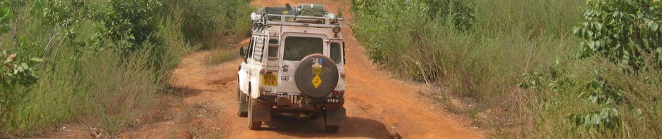
A new day but with a 50% chance of rain and possibly with some severe and much colder weather rolling in but we keep our fingers crossed as we begin the backcountry RIver Road West, a dirt 4×4 road that is actually taking us east for some 50 miles with numerous spur tracks that lead down to the Rio Grande.

The flowers that are early due to the rains that fell for most of February, are wonderful to see. It’s a landscape coloured by native plants, not by human hands. Cactus plants are smothered in buds and the yucca blossoms are attracting butterflies and bees, humming birds will be arriving soon. Hillsides are carpeted with blue bonnets and yellow, daisy-like flowers. We suddenly see a brilliant splash of pink and discover our first cactus in flower.


We reach an area favoured by the Ocotilla plant, its straggly and very prickly stems reaching skyward and ending in bright crimson flowers.

A Roadrunner dashes past us. These birds are able to run at speeds of up to 20 mph enabling them to pursue lizards and small rattlesnakes, which they then peck to death with blows from their beak.

The dirt road remains empty and the views spectacular……..we meet no one.


We take a detour to visit the ruins of Mariscal Mine, a former mercury mine but finally abandoned in 1943………

………and another to Solis on the edge of the Rio Grande. It is here that the huge wall of cliffs that divides the United States from Mexico, finally gives up and merges with the rest of the desert landscape.

The dirt road now continues as the River Road East and late afternoon sun and stormy skies provide an amazing light show, as we finally meet tarmac shortly before Rio Grande Village, where we will camp for the night. This backcountry road has taken us between 5-7hours and we would definitely recommend it to anyone with a high clearance vehicle and a good set of tyres.


The Rio Grande Village Campground has plenty of trees and many birds. Small, bright red Vermillion Flycatchers flash between the trees and we have a woodpecker close by. We are also supplied with bear proof boxes if needed, as black bears have made a successful return to the park. There’s a grocery store a short distance away with a laundry room and shower block…$1.50 for 5 minutes of wonderful hot water!


The sky has been looking very stormy and suddenly a strong wind springs up. By the time we return to our campsite. it must be almost gale force and getting colder by the minute…..the cold front with icy storms that was predicted, has arrived with a vengeance! Our Land Rover is rocking as the wind slams against it, so there is no way we can safely put our roof up to sleep. The birds have disappeared, bird song has gone and lightning streaks the sky followed by claps of thunder. We unfortunately don’t have electricity, so can’t have heating. We spend a cold night trying to get comfortable on the seats but that’s preferable to having our tent ripped apart.
At 7a.m. it’s freezing cold, with the strong wind still with us adding a bitter chill to the temperature. “Grandma’s Cookies’ from the grocery store are all we have left, but go great with a hot cup of tea before we decide to be off and out of the park. A sifting of snow has fallen over the Grapevine Hills and the sun is struggling to give a glow to the Rosillos Mountains. We’ve had two very enjoyable days but this freezing wind is going to make things really unpleasant today. We are going to head on to our next state of Louisiana, America’s deep south.

So it’s on to Marathon and a little cafe for lunch, where we learn that there have been snow storms in Alpine, Marfa and Stockton.
Del Rio next, where the Armstad Dam has created a huge reservoir on the Rio Grande and boats are as common as cars. We have not judged our distances well today as it’s already dark and we still have 50 miles to Kerrville where we take a Super 6 motel for the night which are always good value. The sky however, is completely clear with an enormous, perfectly round, golden moon just hanging in the sky,
We spend three days camping in torrential rain in San Antonio. Fields are under water as we leave, ditches have turned into rivers and spray and visibility are bad on the fast, 4-lane highways into Houston……we pass a number of accidents.
Soon after Beaumont, we leave Texas behind and cross the state border into Louisiana and not long after here, Moby’s speedometer changes to 200,000 miles!
