26th March – 15th April – Never having visited Florida before, when I hear or see the word – sunshine, The Keys, Orlando and Cape Canaveral spring to mind but there is so much more to explore that is remote, laid-back and less developed. If you like miles of white, deserted beaches and clear, aquamarine seas plus plenty of wildlife amongst the coastal marshlands, dunes, forests and barrier islands, then you will love this area of the Florida panhandle around the Gulf of Mexico, commonly known as ‘The Forgotten Coast.’
Although it is raining hard when we leave Alabama there is plenty of sunshine once in Florida. Two bridges, the Pensacola Bay Bridge and then a toll bridge over the Santa Rosa Sound bring us to Santa Rosa Island, part of the Gulf Islands National Seashore.

This fragile island has weathered numerous hurricanes, acting as a barrier during violent storms by helping to block the ocean’s waves that might otherwise strike the mainland with greater force. Located along Florida’s famous Emerald Coast, the beach stretches into the distance, its white sand made up of tiny quartz crystals, held together by plants that have adapted to this harsh environment where the wind and waves are constantly reshaping the island. It is a habitat for many shore birds, small animals and nesting sea turtles but the latter not until a bit later in the year.


The U.S. government began fortifying Pensacola in the 1800s and Fort Pickens was completed in 1834 on Santa Rosa Island. The largest of 4 forts that were built to protect the bay, Pickens played a critical role in preserving peace and as an obstacle to invaders.


A walk to this fort is a must, following one of the many walking trails on the island. We stop on a small bridge over a bayou to admire a heron standing motionless on a log with two turtles, watch other herons nesting and wait patiently on the bridge for more turtles to arrive.


Fort Pickens Campground is located on Santa Rosa Island, with all amenities and only short walking distances to either the Gulf of Mexico with its miles of white sand beaches, or calmer Pensacola Bay. More trails can be followed inland through the centre of the island, where ospreys are guarding their nests in high trees. We never tire of watching these beautiful birds that seem to be surprisingly used to people.


Back at our campground we meet Dolly and Steve who bring us over some delicious cookies from Louisiana and Lois and her husband from Madison in Wisconsin who are intrigued by our number plate. She gives us their home address in case we are passing that way. More kind gestures from strangers but who share the same interest of travelling and camping.
The evening before we leave, an osprey lands in a nearby tree clutching a large fish that it has caught. We seem to have arrived at a great time for watching wildlife!

And so we decide to move on from this beautiful, wild and natural campground a little further along to Destin, where we have been told by the Visitor Centre that there is only one camping space left at the Topsail Hill State Park….first come, first served so they won’t reserve. As it happens, when we arrive we have 4 places to choose from. We have come to the conclusion that there is more chance of getting a space if we appear in person, rather than making a phone call. Perhaps I will eat my words later on, as all campsites are very full at the moment due to schools closed for the Easter break.
This campground resembles a huge parkland that would have belonged to an estate. In fact it once belonged to two ladies who donated it to the government with the provision that it would be kept in its natural state and not built on. Its habitat is unique in that it has many large lakes, some amongst the campground and others nearer the beach. It’s interesting to see how the vegetation changes out on the hiking trails that eventually lead down to the sea, often sheltered by large dunes and pine trees.


Fighter planes are coming in to land as we pass the Tyndall Air Force Base continuing on our way around the coast for Mexico Beach. The sugar-like white sand that makes up this long stretch of beach, is quite rare in that it contains only evenly sized quartz crystals that originated millions of years ago in the Appalachian Mountains. Because the area lacks the influence of silt-bearing rivers, the sand here has remained pure and white. Mexico Beach is also said to average 320 days of sunshine a year and today is no exception!
A short distance from here is Port St. Joe and we head out along the narrow peninsula with fingers crossed that we will find a camping place at St. Joseph Peninsular State Park. Not so lucky this time however, but we are allowed to camp overnight in the overflow parking area and hopefully we can get a site tomorrow. The ‘no-see-ums’ arrive at dusk, biting relentlessly and finding their way through our mosquito netting. It’s a quiet night as we are the only people here.
We are surprised to see deer amongst the dunes as we arrive at the park gate office at 8.a.m. the next morning and finally manage to get a camping place for one night. The dunes in this state park are said to be the tallest east of Mississippi.

Opened in 1967 and located across the bay from Port St. Joe on a long strip of land, St Joseph Peninsular State Park has some 9 miles of white sand beaches and aqua-blue waters. Hiking can be next to the open ocean, where a fisherman tells us that a little while ago, a large shark swam past him close to the shore …………


………or through the interior to the sheltered bay with calmer waters, where pelicans and other sea birds rest and watch the world go by.


Continuing our way around the Gulf to St. George Island, we pass through the small town of Apalachicola. Once the 3rd largest port on the Gulf of Mexico,its waters were once filled with steamboats and schooners, with railroads and lumber mills close by. Today this town has lots of charm with its tree lined streets, a good choice of cafes and restaurants serving fresh sea food, art galleries and many individual specialist shops, plus a working waterfront, the river and bay providing great salt and fresh water fishing.
St. George Island State Park is another of Florida’s barrier islands occupying nearly 2000 acres. The excellent Dr. Julian G. Bruce Campground is at the far eastern end of the island, where we have a quiet and secluded site and hope to be able to stay here for a few days and explore some of the 9 miles of undeveloped sandy coves, beaches and dunes, salt marshes, pine and oak forests and scrub, all of which provide homes for a variety of wildlife. Our camping place has already provided us with an interesting combination including a little Beach Mouse, listed as a state endangered species due to loss of habitat and a cute green frog hiding in our electricity supply box. We also have owls hooting close by at night.


We have a trail close by that leads to the bay, we seem to be the only people who use it so have this stretch of beach to ourselves each day. Tall trees line the edge providing nesting sites for ospreys. The water is clear and warm as the tide drifts out, little fish darting about and crabs shuffling through the sand. Many interesting shells but always something having made its home inside. A heron treads slowly through the water at the edge of the beach, on the look out for a meal.


Walking in the opposite direction along the bay towards the end of George Island, it’s more remote and without shade. Bald Eagles have made two enormous nests in trees further inland.


And then there is the open ocean, sand dunes and forest, mists that roll in from the sea in the early morning and beautiful sunsets ………


………we would certainly recommend this island and its excellent campsite if you enjoy natural surroundings, wildlife viewing, hiking, biking and fishing.
As we leave St. George Island we stop by the lighthouse in town to check emails, an unlikely place but internet can be obtained here! We head for Horseshoe Beach after Bill helps a guy who is having a problem starting his car in a supermarket car park at Cross City. He turns out to be the owner of the Marina there and suggests we make a visit to experience a way of life similar to how it was 30 years ago in Florida.
Horseshoe Beach does turn out to be a hidden gem, not a beach but a haven for boaters and fishing. After being hit hard not long ago by a hurricane and flooding, houses are built high on concrete stilts with covered areas for their boats and/or RV. Most are built overlooking the waterways that have been designed to have easy access to the Gulf of Mexico. It’s a very laid back and sleepy place, the main activities centred around maintaining boats and getting fishing gear ready. Camping is next to a waterway and pelicans seem to be everywhere, sitting on posts and buildings, bobbing on the water or gliding silently overhead.


A guy with his son set up their tent next to us having arrived in their truck pulling a boat, so we expect to be woken early by these enthusiastic fishermen as we are also parked not far from the boat ramp. As anticipated, at 5.30 a.m. we are woken as our neighbours prepare for their fishing trip. If you can’t beat ’em then join ’em, so we are up early too!
Manatee State Park is home to one of Florida’s largest freshwater springs that joins the nearby Suwannee River on its way to the Gulf of Mexico. These large springs are called ‘first magnitude’ because they discharge at least 65 million gallons of crystal clear water every day. In this State Park, the protected rivers and springs provide an important refuge for West Indian Manatees from November to April. These round, seal-like mammals can be seen resting here, enjoying the warm 72 degree F spring water. Unfortunately they are not around during our stay here camping but the trails through the turquoise pools, forests and swamps are still worth exploring.


Cedar Key, approximately half an hour from Manatee State Park following Highway 24 through salt marshes crossed by a series of bridges, is definitely worth a visit. Nestled amongst many small islands, 4 miles out in the Gulf of Mexico, this small, quiet town named after the large number of cedar trees that once covered the islands, today caters for the many tourists and an interesting blend of artists, who display their work in local galleries and shops. The Big Dock on Dock Street is considered to be the heartbeat of Cedar Key, a collection of wooden buildings suspended over the waters of the Gulf.


From here we visit the nearby Lower Suwannnee National Wildlife Refuge, established to protect and maintain a beautiful and rare ecosystem of nearly 53,000 acres. We had the tree lined dirt roads to ourselves. but wished we had kayaks to explore the quiet creeks that led into the Suwannee…..maybe next time!
And so we head a little further south to Crystal River and Homosassa where I want to visit the Ellie Schiller Homosassa Springs Wildlife State Park, a rehabilitation centre for injured and orphaned West Indian Manatees which reside in their fresh water spring before being released back into the wild. Being the weekend however, everywhere is so busy that we decide to give it a miss and return north to Rainbow Springs State Park near Ocala.
How lucky are we to get the one and only free camping space here in this beautifully kept State Park. The Rainbow River is another first-magnitude, spring-fed river, designated by the State of Florida as an Outstanding Florida Waterway and Aquatic Preserve, supporting abundant wildlife, including otters, alligators and many species of fish, turtles and bird life. We visit the nearby Headsprings and follow the Rainbow River away from the weekend crowds, where trails take us past numerous small waterfalls and we can quietly spot a little of the wildlife!


Every afternoon now storm clouds begin to build, bringing a welcome drop in temperature following the thunderstorms and heavy rain. We keep an eye out for the two resident black snakes in our camping area but am sure there are many more in this dense undergrowth and surrounding forest.

This campground with its many private and spacious sites, is certainly one to be recommended. The restrooms are modern and clean and rarely occupied, as the majority of campers here are in big RV’s or large trailers with all facilities….good for us without such luxuries! Must admit though, that air conditioning would sometimes be nice in this very hot and humid weather but our little fan is working overtime!
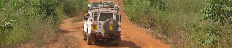
After getting the underneath of our Land Rover jet washed in town to remove all the coastal salt and mud, we leave via Ocala/Marion County. With over 700 thoroughbred horse farms throughout the area, it has come to be known as “The Horse Capital of the World.” We didn’t see many horses however, only huge ranches with sweeping, emerald fields and long, tree-lined driveways.
Florida’s ‘Forgotten Coast’ has been great. The sky is once again looking stormy and as we cross the state line into Georgia, the heavens open.
